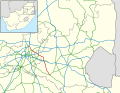
Bapsfontein is a farming town in Ekurhuleni, South Africa, and falls into the Elandsvlei Conservancy area. It is situated at the intersection of the R25...
5 KB (251 words) - 18:52, 28 January 2024
Soweto Naturena Mmao town Alberton Bedfordview Benoni Boksburg Brakpan Bapsfontein Clayville Daveyton Duduza Edenvale Holfontein (Etwatwa) Germiston Isando...
11 KB (210 words) - 08:25, 9 September 2024

Africa that connects Johannesburg with Groblersdal via Kempton Park, Bapsfontein and Bronkhorstspruit. The R25 begins in the suburb of Saxonwold, just...
7 KB (673 words) - 15:59, 10 September 2024
south-east to Bapsfontein, Ekurhuleni. The distance from the N1 intersection in Pretoria to Bapsfontein is 30 km. Upon entering Bapsfontein, the R50 meets...
7 KB (577 words) - 16:04, 10 September 2024

South Africa that connects Bapsfontein with the N3 north of Villiers, via Springs, Nigel and Balfour. The R51 begins at Bapsfontein, Ekurhuleni, Gauteng at...
6 KB (513 words) - 16:06, 10 September 2024

(westbound) and Princess Avenue (eastbound). The R51 runs north-south from Bapsfontein, just outside Benoni towards Springs and barely by-passes Benoni to the...
12 KB (817 words) - 04:32, 27 August 2024

from the N1 in the south-east of the city, and heads south-east towards Bapsfontein and Delmas. The R511 runs north–south from Sandton towards Brits and...
94 KB (9,231 words) - 13:06, 26 September 2024

northern suburbs from north-east to south-west linking the city with Bapsfontein and Bronkhorstspruit to the north-east and Johannesburg to the south-west...
21 KB (1,688 words) - 13:26, 5 October 2024

Bandelierkop Limpopo Bandur Limpopo Bank, Gauteng Gauteng Bankkop Mpumalanga Bapsfontein Gauteng Barakke Eastern Cape Barberspan North West also Leghadighadi...
39 KB (38 words) - 17:27, 10 June 2024

highway (OR Tambo Airport highway) on the western side and the R50 (Delmas-Bapsfontein) road on the north-east. The mean elevation above sea level is approximately...
13 KB (1,098 words) - 11:20, 17 March 2024