
and Sumba. Beinisvørð has vertical cliffs facing the sea and a green slope down towards the village of Sumba. The triangular top of Beinisvørð is visible...
4 KB (504 words) - 16:39, 28 April 2023

is possible to climb Beinisvørð from the rear of the cliffs even if it is pretty steep. In 1975 a part of the top of Beinisvørð fell into the sea. The...
10 KB (885 words) - 22:41, 2 October 2023

most famous peak is definitely the mountain of Beinisvørð northwest of the village of Sumba. The Beinisvørð and its scenery have been praised by the local...
21 KB (2,228 words) - 23:00, 5 August 2024

Beinisvørð, on the west coast of Suðuroy...
151 KB (16,026 words) - 00:53, 21 September 2024

Islands of the Faroe Islands Native name: Føroyar Beinisvørð, Suðuroy Geography Location Norwegian Sea, Atlantic Ocean Coordinates 62°00′N 06°47′W / 62...
4 KB (72 words) - 03:01, 2 September 2022

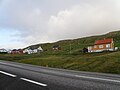
The mountain in the background is Beinisvørð, 470 metres high, often mentioned in Poul F. Joensen's poems. Beinisvørð has a green slope up to the top on...
8 KB (915 words) - 14:44, 15 July 2023

municipality of Sumba. Kirvi seen from Porkeri Kirvi, right the cliff Beinisvørð Kirvi is in the center of this photo View from Porkeri towards Lopra and...
1 KB (124 words) - 02:04, 14 May 2023
Nes, Vágur (section View to Beinisvørð from Nes)
villages are Akrar and Lopra. One can also see the promontory sea cliff Beinisvørð, which rises 470 metres above the sea; the top of it rises above the village...
5 KB (225 words) - 07:01, 25 July 2024

the edge, when you come to Loprans Eiði. From Lopranseiði you can see Beinisvørð towards south and almost half of the west coast of Suðuroy. A Dutch ship...
11 KB (990 words) - 14:55, 7 May 2024

(300 m). Above Sea Beachy Head, England, 162 m above the English Channel Beinisvørð, Faroe Islands, 470 m above North Atlantic Belogradchik Rocks, Bulgaria...
30 KB (3,222 words) - 20:57, 21 September 2024