
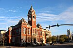
Hightsville is a census-designated place (CDP) in New Hanover County, North Carolina, United States. The population was 739 at the 2010 census. It is part...
6 KB (428 words) - 13:56, 2 August 2023
Carolina Beach Kure Beach Wrightsville Beach Cape Fear Federal Point Harnett Masonboro Wilmington Bayshore Blue Clay Farms Castle Hayne Hightsville Kings...
32 KB (2,454 words) - 18:03, 11 August 2024

Cape Fear (region) (redirect from Wilmington, North Carolina Metropolitan Area)
Beach Bald Head Island Bayshore Blue Clay Farms Castle Hayne Hampstead Hightsville Kings Grant Kirkland Masonboro Murraysville Myrtle Grove Northchase Ogden...
15 KB (890 words) - 18:43, 28 June 2024
U.S. Route 421 (redirect from U.S. Route 421 (North Carolina–Indiana))
states of North Carolina, Tennessee, Virginia, Kentucky, and Indiana. The highway runs for 941 miles (1,514 km) from Fort Fisher, North Carolina, to US 20...
17 KB (1,687 words) - 11:31, 9 August 2024
North Carolina Bayshore, North Carolina Blue Clay Farms, North Carolina Castle Hayne, North Carolina Hightsville, North Carolina Kings Grant, North Carolina...
29 KB (2,294 words) - 14:03, 12 July 2024
System that runs from Fort Fisher, North Carolina to Michigan City, Indiana. In the U.S. state of North Carolina, US 421 travels 328 miles (528 km) from...
49 KB (3,479 words) - 14:14, 21 May 2024
This is a list of census-designated places in the U.S. state of North Carolina. Census-designated places (CDPs) are unincorporated communities lacking...
50 KB (174 words) - 15:14, 3 March 2024

community of Hightsville. Following Castle Hayne Road to the north, NC 133 goes through Wrightsboro, a census-designated community north of downtown Wilmington...
25 KB (2,407 words) - 04:22, 19 March 2023