
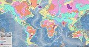
An isopach map (/ˈaɪsoʊpæk/) illustrates thickness variations within a tabular unit, layer or stratum. Isopachs are contour lines of equal thickness over...
3 KB (291 words) - 08:50, 10 December 2023
stratum illustrating the subsurface topographic trends of the strata. Isopach maps detail the variations in thickness of stratigraphic units. It is not...
12 KB (1,578 words) - 02:41, 5 September 2024

Contour line (redirect from Contour map)
Isopach maps use isopachs (lines of equal thickness) to illustrate variations in thickness of geologic units. In discussing pollution, density maps can...
36 KB (4,367 words) - 18:51, 23 September 2024

does cause an increase in seismic amplitude which can be used with an isopach map to determine net pay. In the mid-1980s the Ekofisk field as a whole and...
12 KB (1,262 words) - 02:16, 31 August 2024
Geology, Southern Illinois University Press. Outerbridge, W.F., 2003, Isopach map and regional correlations of the Fire Clay tonstein, central Appalachian...
9 KB (1,196 words) - 04:00, 7 December 2023
recorded from 1966 to 1970, coupled with well data defined lithofacies and isopach maps indicating large delta systems. Relative amplitude seismic profiles reveal...
9 KB (1,066 words) - 21:55, 5 August 2024
there was a basement high area gently dipping to the north identified by isopach maps. Thus sediment thickened quickly to the south. To the north strata changed...
25 KB (2,895 words) - 19:49, 27 November 2023

Figure 2. Detailed isopach map for Yinggehai basin. Modified after Hoang et al., 2010...
10 KB (1,203 words) - 16:30, 4 October 2024

Callide Coal Measures, being deposited in a comparatively stable basin. Isopach maps of the Precipice Sandstone indicate two distinct areas of sediment accumulation...
40 KB (1,409 words) - 03:26, 17 June 2024

An isopach map of the Ordovician graptolitic argillite deposits in northern Estonia, indicating thickness in meters...
10 KB (952 words) - 19:24, 3 November 2023