Josephinian Land Survey (redirect from Josephinische Landesaufnahme)
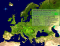
The Josephinian Land Survey (‹See Tfd›German: Josephinische Landesaufnahme) was the first comprehensive land survey and mapping of the Habsburg Empire...
1 KB (149 words) - 19:07, 24 September 2023

Sighișoara in the Grand Duchy of Transylvania, 1769–1773. Josephinische Landesaufnahme...
20 KB (1,631 words) - 02:26, 4 September 2024

The Kingdom of Hungary on the Josephinische Landesaufnahme Original Map, 1782–1785...
44 KB (4,640 words) - 16:58, 5 October 2024

dell'Allio. Other important sources are the Josephinische Landesaufnahme and the Franziszeische Landesaufnahme, which were large-scale maps prepared for...
177 KB (22,264 words) - 13:31, 18 September 2024
Clausenburg in the Grand Duchy of Transylvania maps, 1769–1773. Josephinische Landesaufnahme...
217 KB (19,310 words) - 15:35, 24 September 2024

Sânnicolau Mare (Gros St. Miklosch) on the Josephinische Landesaufnahme of 1769–1772...
47 KB (5,890 words) - 02:28, 4 September 2024

Josephinische Landesaufnahme. Senzitive map of the Arad county, 1782-1785. (Click on the desired quadrant)...
25 KB (1,462 words) - 21:24, 21 September 2024

in fact stony, devoid of trees and shrubby vegetation. On the Josephinische Landesaufnahme maps the area of Mount Cocusso has marked toponyms: Berg Monte...
18 KB (1,873 words) - 20:22, 4 April 2024

ownership structure also remains unknown. On the maps of the Josephinische Landesaufnahme from 1787, the castle is referred to as altes Gschloss. One of...
49 KB (6,447 words) - 04:38, 19 August 2024

Făget (Facshet) on the Josephinische Landesaufnahme of 1769–1772...
12 KB (1,008 words) - 02:37, 4 September 2024