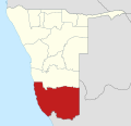
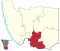
Karasburg was a constituency in the ǁKaras Region of Namibia. The main towns were Karasburg and Grünau; other populated places included Warmbad and Aussenkehr...
4 KB (312 words) - 12:43, 20 July 2024
Region of southern Namibia and the district capital of the Karasburg electoral constituency. It lies at the heart of the southern Namibian sheep farming...
12 KB (873 words) - 07:14, 19 May 2024
ǁKaras Region (section Constituencies)
constituencies: Berseba Karasburg East (created 2013 from a split of Karasburg Constituency) Karasburg West (created 2013 from a split of Karasburg Constituency)...
14 KB (1,384 words) - 18:00, 7 November 2024
Karasburg West is an electoral constituency in the ǁKaras Region of Namibia. As of 2020[update] the constituency had 6,609 registered voters. Karasburg...
3 KB (278 words) - 23:06, 1 January 2022
Karasburg East is an electoral constituency in the ǁKaras Region of Namibia. As of 2020[update] the constituency had 6,553 registered voters. Karasburg...
3 KB (260 words) - 12:52, 27 April 2021
electoral constituencies. The size of the constituencies varies with the size and population of each region. There are currently 121 constituencies in Namibia...
21 KB (712 words) - 00:23, 5 August 2024
Hydnora africana Flowers, Karasburg Constituency, Namibia Partially opened flower, near Robertson, South Africa Scientific classification Kingdom: Plantae...
11 KB (1,260 words) - 12:01, 4 July 2024
right on the border with South Africa. Aussenkehr falls within the Karasburg Constituency of the ǁKaras Region and is situated 24 kilometres (15 mi) downstream...
8 KB (549 words) - 15:01, 3 November 2024
of Karasburg. It is linked to the South African border posts near Noordoewer via the B1 and near Nakop via the B3. Grünau belongs to the Karasburg electoral...
5 KB (108 words) - 22:21, 12 April 2024
situated south of Karasburg at the Homs River, close to the border with South Africa, and belongs to the Karasburg electoral constituency. First occupied...
14 KB (1,146 words) - 22:34, 12 April 2024


