
The Ordnance Survey (OS) is the national mapping agency for Great Britain. The agency's name indicates its original military purpose (see ordnance and...
84 KB (8,586 words) - 18:31, 9 July 2024
Ordnance Survey Ireland (OSI; Irish: Suirbhéireacht Ordanáis Éireann) was the national mapping agency of the Republic of Ireland. It was established on...
13 KB (1,455 words) - 19:56, 21 May 2024

The Ordnance Survey National Grid reference system (OSGB), also known as British National Grid (BNG), is a system of geographic grid references used in...
19 KB (2,130 words) - 10:53, 28 May 2024

Ordnance Survey Ordnance Survey of Northern Ireland United States The National Geodetic Survey (NGS; formerly United States Coast and Geodetic Survey) The...
10 KB (1,053 words) - 15:27, 3 July 2024
The Ordnance Survey International or Ordnance Survey Overseas Directorate its predecessors built an archive of air photography, map and survey records...
11 KB (973 words) - 14:05, 7 June 2024

An ordnance datum (OD) is a vertical datum used by an ordnance survey as the basis for deriving altitudes on maps. A spot height may be expressed as above...
7 KB (777 words) - 16:41, 20 May 2024
The Board of Ordnance was a British government body. Established in the Tudor period, it had its headquarters in the Tower of London. Its primary responsibilities...
66 KB (8,276 words) - 09:15, 13 April 2024
the basis for deriving altitudes on maps Ordnance Survey, the national mapping agency for Great Britain Ordnance Corps (disambiguation) This disambiguation...
723 bytes (106 words) - 01:45, 23 May 2023
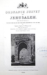
The Ordnance Survey of Jerusalem of 1864–65 was the first scientific mapping of Jerusalem, and the first Ordnance Survey to take place outside the United...
12 KB (1,579 words) - 17:18, 17 February 2023

Topography (redirect from Topographic survey)
original sense. Detailed military surveys in Britain (beginning in the late eighteenth century) were called Ordnance Surveys, and this term was used into the...
16 KB (1,983 words) - 02:36, 16 June 2024