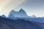
Rinrijirca (possibly from Quechua rinri ear, Ancash Quechua hirka mountain, "ear mountain") is a mountain in the Cordillera Blanca in the Andes of Peru...
2 KB (110 words) - 22:25, 15 April 2022
5,830 metres (19,127 ft) Santa Cruz Norte, 5,829 metres (19,124 ft) Rinrijirca, 5,810 metres (19,062 ft) Santa Cruz Chico, 5,800 metres (19,029 ft) Tullparaju...
18 KB (1,780 words) - 12:32, 29 April 2024
the Huaylas Province, Yuracmarca District (Pucajirca Central) north of Rinrijirca. Its slopes are within Huascarán National Park. The mountain has three...
4 KB (268 words) - 14:25, 6 March 2024
lies inside Huascarán National Park, south east of Pucajirca and east of Rinrijirca. There are a number of routes, but there is no easy way to climb this...
3 KB (346 words) - 01:56, 16 April 2022
Punta) Peru 5,810 Rinrijirca Cordillera Blanca 8°53′40″S 77°36′39″W / 8.89444°S 77.61083°W / -8.89444; -77.61083 (Rinrijirca) Peru 5,808 Tocorpuri...
61 KB (174 words) - 21:34, 18 April 2024
Santa Cruz District. It is at the foot of the mountains Pucajirca and Rinrijirca and the Arhuay glacier. escale.minedu.gob.pe - UGEL map of the Huaylas...
1 KB (63 words) - 22:45, 10 July 2020
pass, the highest point of the Santa Cruz valley, south of the mountains Rinrijirca and Pucajirca, southwest of Taulliraju, and northeast of mountains Artesonraju...
3 KB (154 words) - 01:54, 16 April 2022


