
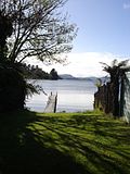
The Tikitere Graben is a intra-rift graben in the North Island of New Zealand that contains the Ohau Channel, which drains Lake Rotorua into Lake Rotoiti...
10 KB (1,066 words) - 00:30, 14 April 2024

and Hauraki Plains of Hauraki Rift (Hauraki half grabens), North Island, New Zealand Tikitere Graben within the Taupō Rift, North Island, New Zealand...
8 KB (851 words) - 07:32, 22 April 2024

Tikitere, also known as "Hell's Gate", is a suburb in Rotorua's most active geothermal area on State Highway 30, between Lake Rotorua and Lake Rotoiti...
19 KB (2,180 words) - 16:17, 26 May 2024
There is geothermal activity in the city, and the geothermal areas of Tikitere and Whakarewarewa are associated with the caldera. These areas are still...
14 KB (1,128 words) - 15:11, 3 April 2024

continuation of the known fault defining the southern limit of the Tikitere Graben. The lake has one major inflow, the Waimata Stream, on the south side...
8 KB (564 words) - 06:55, 12 April 2024
with Lake Rotorua through the Ohau Channel depends upon the sinking Tikitere graben which is also very geothermally active on the south eastern margins...
11 KB (988 words) - 04:51, 29 July 2024

Taupō Volcanic Zone (category Rifts and grabens)
083°S 176.300°E / -38.083; 176.300 (Mokoia Island) Geothermal fields Tikitere/Hell's Gate 38°03′54″S 176°21′40″E / 38.065°S 176.361°E / -38.065; 176...
108 KB (6,919 words) - 18:59, 29 July 2024