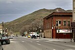
Malheur County (/mælˈhɪər/ mal-HEER) is one of the 36 counties in the U.S. state of Oregon. As of the 2020 census, the population was 31,571. Its county...
29 KB (2,542 words) - 19:13, 30 October 2024
The Malheur National Forest is a National Forest in the U.S. state of Oregon. It contains more than 1.4 million acres (5,700 km2) in the Blue Mountains...
11 KB (551 words) - 08:11, 19 October 2024
The Malheur River (/ˈmælhjʊər/ MAL-hure) is a 190-mile-long (306 km) tributary of the Snake River in eastern Oregon in the United States. It drains a...
11 KB (898 words) - 16:56, 25 October 2024
militants seized and occupied the headquarters of the Malheur National Wildlife Refuge in Harney County, Oregon, and continued to occupy it until law enforcement...
186 KB (17,921 words) - 05:38, 1 November 2024
unincorporated community straddling the Nevada–Oregon border, in Humboldt County, Nevada, and Malheur County, Oregon, United States. McDermitt's economy has...
23 KB (1,501 words) - 10:35, 8 August 2024
Ontario is the largest city in Malheur County, Oregon, United States. It lies along the Snake River at the Idaho border. The population was 11,645 at the...
31 KB (2,591 words) - 12:52, 1 October 2024
Vale is a city in and the county seat of Malheur County, Oregon, United States, about 12 miles (19 km) west of the Idaho border. It is at the intersection...
17 KB (1,294 words) - 06:47, 3 May 2024
Umatilla counties); northeast Oregon (Baker, Union, and Wallowa counties); and southeast Oregon (Grant, Harney, and Malheur counties). Some definitions of the...
24 KB (2,303 words) - 02:22, 4 September 2024
Time in Oregon is divided into two zones, with the vast majority in the Pacific Time Zone. Most of sparsely populated Malheur County, including its largest...
3 KB (220 words) - 17:26, 26 October 2024
Linn County, Oregon, an unincorporated community Riverside, Malheur County, Oregon, an unincorporated community Riverside, Umatilla County, Oregon, a census-designated...
764 bytes (100 words) - 18:52, 28 April 2021


