46°39′22″N 6°33′00″E / 46.656°N 6.550°E / 46.656; 6.550 The Canal d’Entreroches (English: canal between the cliffs) was planned in the 17th century as a...
7 KB (989 words) - 22:36, 30 January 2023
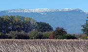
The lowest col between the Jura and the Alps is located at the Canal d’Entreroches (in Switzerland), at approximately 460 metres above sea level. Retrieved...
2 KB (127 words) - 15:56, 9 June 2024
This is a list of navigable canals that are at least partially located in Switzerland. The canals are listed here in alphabetic order of the name (without...
2 KB (36 words) - 16:23, 11 September 2022
rivers Rhône and Rhine via the Lake of Geneva - the Venoge - and the Canal d’Entreroches - La Thielle - Aare. It unfortunately remained unfinished. A commercial...
3 KB (263 words) - 13:36, 14 June 2024

Bridge over the Canal d'Entreroches in Orny...
18 KB (2,075 words) - 23:08, 22 March 2024

the Canal d’Entreroches was dug through the Entreroches gorge, enabling water transportation between the Rhone and the Rhine rivers. The canal ceased...
8 KB (820 words) - 09:42, 18 July 2023

historical population is given in the following chart: The abandoned D’Entreroches canal and Le Mormont, a proto-historic through Iron Age archeological site...
18 KB (2,144 words) - 22:50, 22 March 2024
Abandoned D'Entreroches Canal...
82 KB (159 words) - 21:38, 28 July 2024