Administração Regional da Candangolândia" (in Brazilian Portuguese). Retrieved 2023-06-28. Wikimedia Commons has media related to Candangolândia. Regional Administration...
6 KB (306 words) - 11:12, 9 August 2024

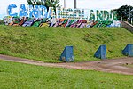
Taguatinga Serejão, Taguatinga Water reserve in Ceilândia States' Square, Candangolândia Greater rhea sculpture, Recanto das Emas Águas Claras Park Brazil portal...
40 KB (3,656 words) - 20:35, 25 September 2024
in part by the vast publicity the city received. Nearby Velhacap was Candangolândia, and other smaller settlements arose in gaps left by the pilot plan...
19 KB (2,239 words) - 13:36, 16 June 2024

da Silva 10 January 1960 10 January 1994 (administrative region) XIX Candangolândia Pablo de Sousa Valente Lima 3 November 1956 27 January 1994 (administrative...
24 KB (1,073 words) - 21:45, 1 May 2024

Brazil. It is bordered by SIA to the north, Sudoeste/Octogonal and Candangolândia to the west, Núcleo Bandeirante to the south, Park Way to the southeast...
8 KB (447 words) - 11:42, 9 August 2024

Lake, being bordered by Arniqueira, Park Way, and Guará to the north, Candangolândia to the east, and Park Way and Riacho Fundo to the south. Núcleo Bandeirante...
11 KB (440 words) - 21:59, 27 January 2024

Bandeirante, and Arniqueira in its northern half; and Núcleo Bandeirante, Candangolândia, Lago Sul, Jardim Botânico, Santa Maria, Gama, Riacho Fundo and Riacho...
3 KB (114 words) - 23:36, 27 January 2024