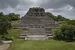
Naranjo (Wak Kab'nal in Mayan) is a Pre-Columbian Maya city in the Petén Basin region of Guatemala. It was occupied from about 500 BC to 950 AD, with its...
11 KB (1,232 words) - 13:08, 2 November 2024
Departmental Capital Cancuén Dos Pilas El Baul Iximche Kaminaljuyu Machaquila El Mirador La Joyanca Mixco Viejo Naranjo Nakbé Piedras Negras Quirigua Q'umarkaj...
13 KB (85 words) - 01:02, 12 March 2024
Guatemala List of airports in Guatemala Google Maps - El Naranjo Airport information for ENJ at Great Circle Mapper. San Jose VOR OpenStreetMap - El Naranjo...
3 KB (99 words) - 09:17, 8 March 2020
important interchange in Guatemala city. On December 17, 2017, Mixco began service on the second line, named "Express Naranjo" with refurbished Transurbano...
5 KB (475 words) - 03:38, 8 April 2023
Flores Santa Cruz Naranjo Santa María Ixhuatán Santa Rosa de Lima Taxisco Guatemala portal Geography portal List of places in Guatemala Citypopulation.de...
12 KB (205 words) - 01:14, 13 August 2024
Naranjo in Wiktionary, the free dictionary. Naranjo is a pre-Columbian Maya archaeological site in Guatemala. Naranjo may also refer to: El Naranjo,...
2 KB (330 words) - 19:32, 9 February 2024
330 years, Guatemala was part of the Captaincy General of Guatemala, which included Chiapas (now in Mexico) and the present-day countries of El Salvador...
252 KB (30,358 words) - 15:14, 6 November 2024
Guatemala and Mexico measures 871 km (541 mi). It runs between north and west Guatemala (the Guatemalan departments of San Marcos, Huehuetenango, El Quiché...
12 KB (1,428 words) - 06:22, 27 June 2024
Xunantunich (section Naranjo)
located atop a ridge above the Mopan River, well within sight of the Guatemala border – which is 0.6 miles (1 km) to the west. It served as a Maya civic...
17 KB (2,075 words) - 18:07, 16 April 2024
Calakmul (redirect from Rebellion at Naranjo)
(22 mi) north of the border with Guatemala and 38 kilometres (24 mi) north of the ruins of El Mirador. The ruins of El Tintal are 68 kilometres (42 mi)...
70 KB (9,200 words) - 08:43, 3 November 2024


