
Swisstopo is the official name for the Swiss Federal Office of Topography (in German: Bundesamt für Landestopografie; French: Office fédéral de topographie;...
17 KB (2,188 words) - 10:47, 17 May 2024

National Maps of Switzerland (redirect from Swisstopo maps)
Switzerland, also referred to as the Swisstopo maps, are a set of official map series designed, edited and distributed by Swisstopo, the Swiss Federal Office of...
4 KB (426 words) - 07:44, 5 September 2023

mountains of Switzerland accessible by public transport Retrieved from the Swisstopo topographic maps. The key col is the Furggeli (1,732 m). Media related...
2 KB (91 words) - 18:13, 7 July 2024

Map 1:25 000. Berne, Switzerland: Swiss Federal Office of Topography – swisstopo. 2012. ISBN 978-3-302-01208-7. Retrieved 2016-08-21. "Harder Kulm". Jungfrau...
3 KB (236 words) - 14:47, 4 May 2024

Muotathal and Unterschächen, east of Lake Lucerne. Retrieved from the Swisstopo topographic maps and Google Earth. The key col is located south of the...
2 KB (67 words) - 21:29, 15 May 2022

"Search.ch" (Map). Schulhaus Hofern. Cartography by search.ch, TomTom, swisstopo, osm. Zurich, Switzerland: Tamedia AG. Retrieved 2015-04-23. "Zentrum...
17 KB (1,517 words) - 11:26, 10 July 2024

Titlis from Pilatus List of mountains of Switzerland Retrieved from the Swisstopo topographic maps [1] and Google Earth. The key col is the Susten Pass...
8 KB (810 words) - 21:15, 28 May 2023
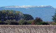
background Retrieved from the IGN topographic maps [1] Retrieved from the Swisstopo topographic maps [2]. The lowest col between the Jura and the Alps is...
2 KB (195 words) - 23:29, 4 September 2024
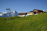
destination of the classic hike: Schynige Platte-Faulhorn-First. Retrieved from the Swisstopo topographic maps Cable car website First on Hikr v t e...
2 KB (69 words) - 16:20, 23 June 2022

mountains of Switzerland accessible by public transport Retrieved from the Swisstopo topographic maps and Google Earth. The key col is located east of the...
4 KB (377 words) - 05:32, 16 September 2024