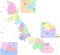
Tlacolulan is a municipality in the Mexican state of Veracruz, about 17 km from the state capital Xalapa. It has a surface of 137.36 km2. It is located...
2 KB (211 words) - 08:10, 9 August 2023
of 1586 this village was formed, on one of the adjoining old men of Tlacolulan's dominion. The decree N ° 64 of November 3, 1893, extinguished the municipality...
10 KB (302 words) - 03:52, 15 July 2024
Coss, to the south-east by Naolinco and to the west by Coacoatzintla and Tlacolulan. It is watered by small tributary rivers of the river Actopan. The weather...
2 KB (238 words) - 15:15, 23 September 2023
Minas, Las Vigas de Ramírez, Perote, Rafael Lucio, Tatatila, Teocelo, Tlacolulan, Tlalnelhuayocan, Villa Aldama and Xico. The district's head town (cabecera...
18 KB (1,059 words) - 03:55, 4 September 2024
632 −3.1% 102.7 39.7 43.7/km2 (113.2/sq mi) March 28, 1831 177 Tlacolulan Tlacolulan 11,685 10,299 +13.5% 133.5 51.5 87.5/km2 (226.7/sq mi) December...
82 KB (1,134 words) - 15:41, 16 July 2024
Miahuatlán, Las Minas, Misantla, Nautla, Perote, Tatatila, Tenochtitlán, Tlacolulan, Tonavan, Vega de Alatorre, Vigas de Ramírez, Villa Aldama and Yecuatla...
16 KB (965 words) - 03:47, 4 September 2024
southeast, Banderilla to the south, Rafael Lucio to the southwest, and Tlacolulan to the northwest. The municipality covers an area of 56.437 square kilometres...
13 KB (650 words) - 12:09, 19 October 2024
south-east by Jilotepec, to the south by Banderilla and to the west by Tlacolulan. The climate in Coacoatzintla is wet and cold with rains all year round...
7 KB (207 words) - 06:54, 14 July 2024
Xalapa. The municipality of Rafael Lucio is delimited to the north by Tlacolulan and Jilotepec, to the southeast by Banderilla, to the south by Tlalnelhuayocan...
7 KB (291 words) - 04:47, 1 March 2024
north by Altotonga, to the north-east by Tenochtitlan, to the east by Tlacolulan and Tenochtitlan, to the south by Las Vigas de Ramírez, and to the west...
6 KB (282 words) - 08:59, 28 February 2024


