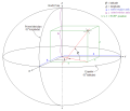
The World Geodetic System (WGS) is a standard used in cartography, geodesy, and satellite navigation including GPS. The current version, WGS 84, defines...
24 KB (2,843 words) - 13:42, 3 August 2024
A geodetic datum or geodetic system (also: geodetic reference datum, geodetic reference system, or geodetic reference frame, or terrestrial reference...
31 KB (3,346 words) - 06:28, 11 August 2024
The Geodetic Reference System 1980 (GRS80) consists of a global reference ellipsoid and a normal gravity model. The GRS80 gravity model has been followed...
7 KB (1,078 words) - 12:07, 24 August 2024
December 25, 2018. National Geospatial Intelligence Agency. "World Geodetic System 1984 datasheet" (PDF). United Nations Office for Outer Space Affairs...
9 KB (904 words) - 13:39, 7 January 2024
EPSG Geodetic Parameter Dataset (also EPSG registry) is a public registry of geodetic datums, spatial reference systems, Earth ellipsoids, coordinate transformations...
5 KB (450 words) - 10:37, 21 July 2024
Web Mercator projection (category Geographic coordinate systems)
MEMBER["World Geodetic System 1984 (Transit)", ID["EPSG",1166]], MEMBER["World Geodetic System 1984 (G730)", ID["EPSG",1152]], MEMBER["World Geodetic System 1984...
16 KB (1,712 words) - 17:02, 17 June 2024
reference for the determining of locators should be based on the World Geodetic System 1984 (WGS-84). A Maidenhead locator compresses latitude and longitude...
16 KB (1,933 words) - 17:06, 1 June 2024
geographic coordinates (latitude and longitude). Examples include the World Geodetic System and the 1927 and 1983 North American Datum. A datum generally consists...
15 KB (1,546 words) - 06:12, 22 May 2024
A geographic coordinate system (GCS) is a spherical or geodetic coordinate system for measuring and communicating positions directly on Earth as latitude...
22 KB (2,491 words) - 18:21, 12 August 2024
Earth ellipsoid (section Geodetic coordinates)
TR8350.2, "Department of Defense World Geodetic System 1984, Its Definition and Relationships With Local Geodetic Systems", Third Edition, 4 July 1997 [1]...
19 KB (2,379 words) - 03:42, 10 July 2024


