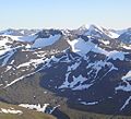
The Zastler Loch or Zastler Cirque (German: Zastlerkar) on the northern side of the Feldberg summit in the Black Forest is the highest cirque in the German...
6 KB (762 words) - 19:17, 4 November 2024
The Zastler Hut (German: Zastler Hütte) is a managed mountain hut situated at a height of 1,256 m above NHN in the Black Forest in Germany. It is located...
4 KB (493 words) - 11:46, 5 November 2024
cirques form one behind the other, a cirque stairway results, as at the Zastler Loch in the Black Forest. As glaciers can only originate above the snowline...
14 KB (1,534 words) - 06:31, 8 November 2024
300 ft) altitude. Deeply incised valleys run northwest towards Freiburg (the Zastler and St Wilhelmer valleys) and southwest towards Basel (Wiesental valley)...
16 KB (2,045 words) - 16:23, 25 October 2024
Bernau, Brandenberg, Hinterzarten, Menzenschwand, St. William, Todtnau and Zastler. What was left of Brandenberg after incorporation to Feldberg became a...
7 KB (774 words) - 16:23, 25 October 2024
lacks the steep headwalls typical of cirques. A well-known example is the Zastler Loch below the summit of the Feldberg, the highest mountain of the Black...
1 KB (139 words) - 00:00, 20 March 2024
To the north it is bounded by the Höllental valley, to the south by the Zastler valley. Nearby settlements include Kirchzarten, Oberried (Breisgau), Falkensteig...
2 KB (116 words) - 19:54, 9 December 2019
Significant natural monuments: Feldberg region with the valley heads of Zastler Loch, Napf (Alpiner Pfad) and Feldseekar Seebach valley with the Feldsee...
5 KB (522 words) - 08:20, 28 October 2024
Baden-Württemberg) Daten- und Kartendienst der LUBW Regional discharge of the Zastler gauge (35 L/s.km2) related to the catchment area of the Krummbach (rounded)...
2 KB (109 words) - 16:24, 25 October 2024
Stülpnagel: Die Gemeinde Oberried mit den Ortsteilen Hofsgrund, St. Wilhelm und Zastler. Freiburg, 1974. Wolfgang Hilger: Geschichte von 68 Höfen und Häusle im...
4 KB (597 words) - 17:41, 4 November 2024


