
The Carrathool Shire is a local government area that borders both the Riverina and Far West regions of New South Wales, Australia. The Shire comprises...
11 KB (448 words) - 14:37, 16 August 2024

Carrathool /ˈkærəθuːl/ is a village in the western Riverina region of New South Wales, Australia, in Carrathool Shire. In 2011 census, Carrathool had...
4 KB (375 words) - 04:37, 20 May 2023

Merriwagga (category Carrathool Shire)
Carrathool Shire Council, Merriwagga Map Carrathool Shire Council, Merriwagga Fact Sheet Archived 2009-07-03 at the Wayback Machine Carrathool Shire Council...
4 KB (333 words) - 19:22, 23 September 2023
Nombinnie Nature Reserve (category Carrathool Shire)
The Nombinnie Nature Reserve is a protected nature reserve in central New South Wales. "Nombinnie Nature Reserve". Office of Environment and Heritage....
2 KB (34 words) - 05:34, 16 December 2023
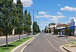
Hillston, New South Wales (category Carrathool Shire)
Hillston is a township in western New South Wales, Australia, in Carrathool Shire, on the banks of the Lachlan River. It was founded in 1863 and at the...
16 KB (1,459 words) - 00:42, 10 May 2024

Goolgowi (category Carrathool Shire)
Sydney via the Mid-Western Highway and is the administrative centre of Carrathool Shire. At the 2016 census, Goolgowi had a population of 402. The town water...
6 KB (645 words) - 23:09, 27 May 2023

Rankins Springs (category Carrathool Shire)
a village in the Riverina region of New South Wales, Australia in Carrathool Shire and on the Mid-Western Highway. At the 2011 census, Rankins Springs...
24 KB (2,995 words) - 13:20, 9 July 2024

South West Woodland Nature Reserve (category Carrathool Shire)
27722°E / -35.083944; 145.27722 13 Goolgowi 101 250 5 September 1958 Carrathool 33°59′18″S 145°46′09.1″E / 33.98833°S 145.769194°E / -33.98833; 145...
12 KB (466 words) - 08:17, 10 July 2024
arid and the main economy is broad acre agriculture. The parish is in Carrathool Shire. Map of the County of Waljeers , (Department of Lands, Sydney N.S.W...
687 bytes (71 words) - 13:50, 8 March 2023

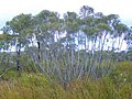
Pulletop Nature Reserve (category Carrathool Shire)
Pulletop Nature Reserve is a protected nature reserve, located in the Cobar Peneplain region of New South Wales, in eastern Australia. The 145 ha (360-acre)...
8 KB (624 words) - 17:00, 9 July 2024