
Engelsmanplaat (Dutch pronunciation: [ˈɛŋəlsmɑmˌplaːt]), or De Kalkman which is its local name, is a small sandbank between the Dutch islands Ameland and...
1 KB (70 words) - 16:58, 22 September 2024
Noorderhaaks, Texel, Vlieland, Richel, Griend, Terschelling, Ameland, Rif, Engelsmanplaat, Schiermonnikoog, Simonszand, Rottumerplaat, Rottumeroog, and Zuiderduintjes...
4 KB (273 words) - 15:26, 18 January 2024
Noorderhaaks Texel Vlieland Richel Terschelling Griend Ameland Rif Engelsmanplaat Schiermonnikoog Simonszand Rottumerplaat Rottumeroog Zuiderduintjes...
3 KB (192 words) - 20:28, 19 December 2022

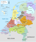
to the west and Schiermonnikoog to the east. This includes the small Engelsmanplaat and Rif sandbanks to the east. Ameland is, counted from the west, the...
13 KB (991 words) - 15:07, 28 September 2024

2 km² and a total of 23,872 inhabitants. Noorderhaaks Richel Griend Rif Engelsmanplaat Simonszand Rottumerplaat Rottumeroog Zuiderduintjes The names of all...
18 KB (2,014 words) - 19:40, 13 September 2024

mudflat hikers can walk from the mainland to Terschelling, Ameland, Engelsmanplaat, Schiermonnikoog, Simonszand, and Rottumeroog. Other mudflat hiking...
4 KB (496 words) - 22:33, 24 February 2023
Dutch Low Saxon dialect or Dutch. Part of the municipality are the Engelsmanplaat sandbank and most of the Rif sandbank (which is shared with Schiermonnikoog...
14 KB (677 words) - 14:48, 5 October 2024

Dutch Wadden Sea, lying between Ameland and Schiermonnikoog, north of Engelsmanplaat. The sandbank has an area of 0.9 square kilometres (0.35 sq mi) at high...
3 KB (91 words) - 05:29, 1 September 2024
01°01’E E-W Eastermost Shoal UK SNS 54°40’N 02°30’E - 54 40.5 Dogger Bank Engelsmanplaat Netherlands SNS 53°27'N 06°03'E Fairy Bank France SNS 51°23’N 02°20’E...
21 KB (724 words) - 16:02, 2 October 2024
M-347 Kriegsmarine World War II: The Type 1940 minesweeper was sunk off Engelsmanplaat, Friesland, Netherlands by rocket-armed Bristol Beaufighter aircraft...
317 KB (5,138 words) - 14:26, 14 September 2024