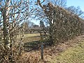
The High Weald Landscape Trail (HWLT) is a 145-kilometre (90 mi) route in England between Horsham, West Sussex and Rye, East Sussex, designed to pass through...
7 KB (877 words) - 10:40, 21 March 2024

The High Weald National Landscape is in south-east England. Covering an area of 1,450 square kilometres (560 sq mi), it takes up parts of Kent, Surrey...
10 KB (1,309 words) - 15:00, 27 February 2024
landscape area; see High Weald Landscape Trail Sevenoaks Weald, a village also known as Weald Weald of Kent Grammar School in Tonbridge Weald of Kent (UK Parliament...
1 KB (170 words) - 19:43, 22 August 2024

Harwood Road (B2195), and Buchan Country Park on the A264. The High Weald Landscape Trail leads from Horsham Station east across the forest to Handcross...
20 KB (3,081 words) - 20:14, 8 June 2024

largely rural in character and landscape, enjoying a gently elevated position which is traversed by the High Weald Landscape Trail. The area has local service...
31 KB (1,004 words) - 07:44, 18 July 2024
Hastings; the 1066 Country Walk leads from Rye to Pevensey; the High Weald Landscape Trail goes to Horsham; and the Royal Military Canal Path follows that...
47 KB (5,301 words) - 06:18, 27 August 2024

footpaths in East Sussex are the South Downs Way; 1066 Country Walk, High Weald Landscape Trail, Saxon Shore Way, Sussex Border Path, Sussex Ouse Valley Way,...
38 KB (3,831 words) - 17:46, 17 June 2024

views across the Ouse valley radiate into the High Weald from Lindfield. The High Weald Landscape Trail and Sussex Border Path pass close to Lindfield...
13 KB (1,439 words) - 16:53, 14 August 2024
to the South Downs Way at Steyning, and on to Shoreham-by-Sea High Weald Landscape Trail, running 145 kilometres from Horsham to Rye (West Sussex, East...
4 KB (505 words) - 15:27, 4 September 2022
List of long-distance footpaths in the United Kingdom (category Lists of hiking trails)
West Camel, viewed from the Leland Trail The Derwent Valley Heritage Way along Whitewells Road A view of the former High Marnham power station on the Trent...
96 KB (2,055 words) - 11:32, 20 August 2024