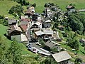
La Forclaz (French pronunciation: [la fɔʁkla]; Arpitan: La Forclla) is a commune in the Haute-Savoie department in the Auvergne-Rhône-Alpes region in south-eastern...
2 KB (80 words) - 03:48, 11 October 2023

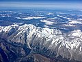
Col de la Forclaz (el. 1,527 m or 5,010 ft) is a mountain pass in the Alps in the Canton of Valais in Switzerland. It connects Martigny at 471 m (1,545 ft)...
5 KB (439 words) - 08:42, 13 April 2024

Great St. Bernard Pass to Aosta (Italy), and the other over the col de la Forclaz to Chamonix (France). In winter, Martigny is known for its numerous nearby...
30 KB (3,415 words) - 22:31, 22 March 2024

ranges. For a part of the way, between the summit of Brevent and the Col de la Croix du Bonhomme, the route coincides with the European long-distance footpath...
7 KB (617 words) - 13:40, 8 July 2024

Martigny or to the Col de la Forclaz. Verbier is around 2 hours' drive from Geneva, 1 hour from Chamonix (Col de la Forclaz) and 1 hour from Aosta (Great...
14 KB (1,786 words) - 01:51, 1 July 2024

Pont du Diable – Crouzet Migette Pont du Diable – Sens Pont du Diable − La Forclaz [[File:Rakotzbrücke.jpg|thumb|Rakotzbrücke, Azalea and Rhododendron Park...
13 KB (1,314 words) - 15:09, 24 June 2024
Montmin has become a tourist attraction renowned for the scenic Col de la Forclaz mountain pass, one of the premier hang gliding and paragliding sites in...
5 KB (522 words) - 08:31, 27 January 2022

wind west for the 13 kilometres (8.1 mi) ascent of the Category 1 Col de la Forclaz to 1,527 metres (5,010 ft), with a partial descent through Trient to Finhaut...
65 KB (3,116 words) - 21:46, 25 January 2024

de la Forclaz and geographically part of the Mont Blanc massif. Retrieved from the Swisstopo topographic maps. The key col is the Col de la Forclaz (1...
1 KB (63 words) - 15:38, 20 March 2024
(path, links Courmayeur – Orsières) Col de Champex 1,497 m (4,911 ft) and La Forclaz, or Fenêtre d'Arpette 2,655 m (8,711 ft) (path and road, links Orsières...
150 KB (13,693 words) - 12:51, 27 May 2024