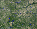
Microsoft Research Maps (MSR Maps) was a free online repository of public domain aerial imagery and topographic maps provided by the United States Geological...
5 KB (511 words) - 10:08, 18 December 2023
Microsoft Research (MSR) is the research subsidiary of Microsoft. It was created in 1991 by Richard Rashid, Bill Gates and Nathan Myhrvold with the intent...
17 KB (1,507 words) - 05:50, 23 August 2024
Microsoft MapPoint is a discontinued software program and service created by Microsoft that allows users to view, edit and integrate maps. The software...
10 KB (950 words) - 11:20, 24 April 2024
applications. Apple Maps – Apple's mapping service Bing Maps Esri – Esri ArcGIS Google Maps – Google's mapping service MapQuest Microsoft Research Maps – public...
3 KB (235 words) - 19:43, 29 May 2024

Microsoft Research Maps. Peninsula Aqueduct manually plotted in Google Earth "Peninsula Aqueduct topographic map". USGS via Microsoft Research Maps. "Deep...
69 KB (3,903 words) - 00:17, 26 August 2024
to integrate maps or geospatial data into applications. Azure Maps differs from Microsoft's other enterprise mapping service, Bing Maps, in its pricing...
28 KB (2,456 words) - 14:58, 13 June 2024

Microsoft Bing, commonly referred to as Bing, is a search engine owned and operated by Microsoft. The service traces its roots back to Microsoft's earlier...
107 KB (9,399 words) - 20:20, 4 August 2024

On May 7, 2018, Microsoft announced the launch of Azure Maps, an enterprise maps API and SDK platform. On June 27, 2018, Microsoft launched Azure IoT...
76 KB (6,018 words) - 14:51, 29 August 2024

(Topographic map). Microsoft Research Maps. Microsoft. Retrieved March 14, 2007. Google (June 13, 2013). "Kansas Turnpike" (Map). Google Maps. Google. Retrieved...
90 KB (9,347 words) - 03:34, 18 August 2024
accessed December 23, 2006 Taken from various USGS topographic maps on Microsoft Research Maps, zoomed in from this general area Victor Skinner (January 10...
23 KB (1,970 words) - 04:17, 15 June 2024