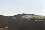
The Sauberge is a hill range up to 317 m above sea level (NN) in the Innerste Uplands in the district of Hildesheim in eastern Lower Saxony in Germany...
4 KB (382 words) - 08:15, 12 June 2024

Heber, Hildesheim Forest, Salzgitter Ridge (including the Lichtenberge), Sauberge and Vorholz. Between these ridges run the following rivers: Innerste, Lamme...
4 KB (429 words) - 07:22, 23 May 2024
Forest Salzberg (257 m), Hildesheim district, Sauberge Ziegenberg (257 m), Hildesheim district, Sauberge Harlyberg (256 m), Goslar district, Harly Forest...
39 KB (3,193 words) - 13:33, 10 October 2023

east. These densely forested hills, which are bordered to the east by the Sauberge and lie a few kilometres west-southwest of the Vorholz, fill an area south...
5 KB (393 words) - 21:44, 20 October 2022

Salzgitter Hills) to the southeast, the Hainberg to the south-southeast, the Sauberge to the south-southwest and the Hildesheim Forest to the west-southwest...
4 KB (342 words) - 04:59, 30 June 2021

is surrounded by other uplands: the Hildesheim Forest to the north, the Sauberge to the east-northeast, Harplage to the east-southeast, the Heber to the...
5 KB (539 words) - 14:07, 16 April 2020
southeastern foothills of the Hildesheim Forest to the north-northeast, the Sauberge to the northeast, the Harplage to the east-northeast, the Heber to the...
6 KB (722 words) - 22:18, 19 October 2023
surrounded by the hills of the Hildesheim Forest to the northeast, the Sauberge to the east-northeast, the Vorberge to the east and the Sackwald to the...
7 KB (625 words) - 18:16, 18 July 2019