
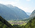
Stuiben is a mountain of Bavaria, Germany. 47°31′N 10°10′E / 47.517°N 10.167°E / 47.517; 10.167 v t e...
570 bytes (26 words) - 18:58, 12 July 2020

self-catering hut although drinks are sold by the proprietor). In winter the Stuiben Hut is used as a self-catering hut for ski tourers and snowshoe trekkers...
14 KB (1,398 words) - 16:13, 14 July 2024

Sedererstuiben Sedererstuiben seen from Stuiben. 2012 Highest point Elevation 1,737 m (5,699 ft) Geography Location Bavaria, Germany...
642 bytes (28 words) - 12:32, 2 August 2024

Nagelfluh chain with mountains like the Hochgrat, the Rindalphorn, the Stuiben and the Steineberg. The increasingly lower mountains north of the Nagelfluh...
33 KB (4,252 words) - 12:54, 4 August 2024

Bernardeinweg to the Kreuzeckhaus (5–6 hours) via the Mauerscharte col, Stuiben Hut and Lower Bernadeinweg to the Kreuzeckhaus (so-called Schützensteig;...
5 KB (387 words) - 14:45, 20 April 2021

of climbing obstacles. Some places, especially between Steineberg and Stuiben, and between Falken and Hochhädrich, are difficult and exposed, requiring...
10 KB (937 words) - 09:27, 7 July 2024
Sedererstuiben 1,737 Prealps west of the Iller Germany 37 Col linking to the Stuiben 6 Stuiben Hahnenkopf 1,735 Höfats and Rauheck Group Germany 15 Col linking to...
148 KB (714 words) - 11:00, 1 November 2022