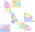
Tihuatlán is a city and its surrounding municipality located in the north of the Mexican state of Veracruz, about 316 km (196 mi) from the state capital...
7 KB (258 words) - 03:59, 8 September 2023
41 rancherías 1 poblado. N: Tamiahua Municipality S: Cazones Municipality E: Gulf of Mexico W: Álamo-Temapache Municipality and Tihuatlán Municipality...
5 KB (116 words) - 01:21, 25 October 2024
still many oil facilities. The city shares borders with the municipalities of Papantla, Tihuatlán, and Coatzintla, and stands on Federal Highway 180. The...
20 KB (1,857 words) - 21:15, 16 October 2024
Veracruz is a state in central eastern Mexico that is divided into 212 municipalities. According to the 2020 Mexican census, it is the fourth most populated...
82 KB (1,134 words) - 15:41, 16 July 2024
Papantla (section The municipality)
Papantla borders the municipalities of Cazones de Herrera, Tecolutla, Gutiérrez Zamora, Martínez de la Torre, Espinal, Coatzintla, Tihuatlán and Poza Rica as...
31 KB (3,322 words) - 00:12, 13 August 2024
Temapache (category Municipalities of Veracruz)
The municipality of Temapache is delimited to the north by Tepetzintla, Cerro Azul and Tamiahua to the east by Tuxpam, to the south by Tihuatlán, Castillo...
6 KB (203 words) - 21:36, 1 September 2023
following municipalities in the states of Veracruz, Puebla, and Hidalgo (Valderrama Rouy 2005:188-189). There is a total of 17 municipalities in the part...
8 KB (98 words) - 15:43, 16 July 2024
Rio Guayalejo and Cerro del Bernal, Municipality of González, Tamaulipas (17 April 2001) Río Sabinas, Municipality of Gómez Farías, Tamaulipas (15 April...
22 KB (2,187 words) - 08:09, 28 October 2024
elections. The reconfigured fifth district covers the municipalities of Poza Rica, Tamiahua, Tihuatlán and Tuxpan in the north of the state. The district's...
16 KB (965 words) - 03:47, 4 September 2024
Cazones de Herrera (redirect from Cazones de Herrera Municipality)
which cover an area of 273.1 km2. It borders the municipalities of Tuxpan, Papantla, Poza Rica and Tihuatlán with the Gulf of Mexico to the east. Aside from...
17 KB (1,497 words) - 20:00, 12 May 2024


