
Coolah is a town in the central western part of New South Wales, Australia in Warrumbungle Shire. At the 2016 census, Coolah had a population of 1,290...
7 KB (592 words) - 09:51, 24 February 2024
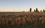
Coolah Airport (IATA: CLH, ICAO: YCAH) is located 6.5 nautical miles (12.0 km; 7.5 mi) northwest of Coolah, New South Wales, Australia. List of airports...
1 KB (54 words) - 23:45, 31 January 2024

Coolah Parish is a civil parish of the County of Napier, a county in the central western part of New South Wales, Australia in Warrumbungle Shire. The...
4 KB (244 words) - 21:00, 21 November 2020

Black Stump (section Coolah, New South Wales)
Hanson, The Pastoral Possessions of New South Wales, Gibbs, Shallard & Co, 1889, p. 334 The Black Stump (Coolah) Archived 20 August 2006 at the Wayback...
18 KB (2,281 words) - 07:41, 5 September 2024

Coolah Tops is a national park located in New South Wales, Australia, 258 kilometres (160 mi) northwest of Sydney, established on 5 July 1996. It is managed...
3 KB (216 words) - 22:49, 5 March 2024
Binnia Street, Coolah, in the Warrumbungle Shire, New South Wales, Australia. It was designed by the Colonial Architect of New South Wales, James Barnet...
5 KB (580 words) - 05:48, 8 September 2023
Orana is a vast region in north-central New South Wales, Australia. As of June 2015[update] it had an estimated population of 113,824 people. It has...
7 KB (478 words) - 09:19, 12 September 2024

western New South Wales. The civil parish is located outside of Coolah, New South Wales, and by some accounts is the location of the proverbial Black Stump...
2 KB (180 words) - 21:00, 18 October 2022
Environment of New South Wales. Abercrombie River National Park Breelong National Park Capertee National Park Conimbla National Park Coolah Tops National...
37 KB (3,664 words) - 08:39, 20 July 2024

September 2020. Parliament of New South Wales (21 December 1915). "CRABOON TO COOLAH RAILWAY ACT. - Act No. 50 1915". "Coolah Branch". www.nswrail.net. Retrieved...
25 KB (2,816 words) - 23:10, 4 May 2024