
The Rangitoto Channel is an area of the Hauraki Gulf in the Auckland Region of New Zealand's North Island. The channel is north-east of the Waitematā Harbour...
6 KB (512 words) - 17:26, 30 May 2024

Shore by the Rangitoto Channel. Since World War II, it has been linked by a causeway to the much older, non-volcanic Motutapu Island. Rangitoto is Māori for...
34 KB (3,712 words) - 22:56, 29 June 2024

eastern side of the school have a view of the Rangitoto Channel as well as Rangitoto Island. Rangitoto College opened in 1956, with an initial roll of...
23 KB (1,821 words) - 01:59, 1 July 2024

islands are separated from the mainland by the Tamaki Strait and Rangitoto Channel. Other islands in the gulf include Browns Island, Motuihe Island,...
22 KB (2,386 words) - 03:12, 10 May 2024

the northwest, the Waitematā Harbour mouth to the south, and the Rangitoto Channel of the Hauraki Gulf to the east. The suburb of Stanley Point can be...
38 KB (3,902 words) - 04:27, 26 May 2024

Gulf, extending west for eighteen kilometres from the end of the Rangitoto Channel. Its entrance is between North Head and Bastion Point in the south...
16 KB (1,744 words) - 08:54, 30 June 2024

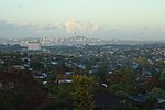
north side. On the eastern coastline of the North Shore, where the Rangitoto Channel divides the inner Hauraki Gulf islands from the mainland, there are...
165 KB (14,245 words) - 04:14, 30 June 2024

D'Urville Island (redirect from Rangitoto Ki Te Tonga)
D'Urville Island (/dɜːrˈvɪl/), Māori name Rangitoto ki te Tonga, is the largest island in the Marlborough Sounds, on the northern coast of the South Island...
10 KB (1,026 words) - 00:20, 15 April 2024

north-east coast of the city along the shore of the Hauraki Gulf and Rangitoto Channel. They include, from north to south, Long Bay, Torbay, Waiake Bay,...
35 KB (3,417 words) - 02:15, 21 February 2024
Rodney District to the north, Waitemata Harbour to the south and the Rangitoto Channel of the Hauraki Gulf to the east. The seat of the council was in Takapuna...
19 KB (1,440 words) - 09:06, 31 May 2024