
census. Listed buildings in Torworth "Area: TorworthCP (Parish)" UK Census (2021). "2021 Census Area Profile – Torworth parish (E04007843)". Nomis. Office...
2 KB (87 words) - 20:17, 23 January 2024
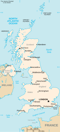
Torworth is a civil parish in the Bassetlaw District of Nottinghamshire, England. The parish contains five listed buildings that are recorded in the National...
6 KB (204 words) - 15:42, 12 October 2023
(Bassetlaw), Thrumpton (Rushcliffe), Thurgarton, Tiln, Tithby, Tollerton, Torworth, Toton, Treswell, Trowell, Tuxford Underwood, Upper Broughton, Upper Saxondale...
10 KB (589 words) - 14:55, 26 August 2024

Sutton Civil parish St. Bartholomew's Church 673 Sutton Torworth Civil parish Great North Road, Torworth 263 Ranskill Treswell Civil parish St. John the Baptist...
38 KB (992 words) - 11:14, 13 October 2024

Lindrick, Costhorpe, Firbeck, Letwell, Maltby, Styrrup with Oldcotes and Torworth. The name "Hodsock" means 'Hod's oak-tree'. The area is 4 miles north east...
8 KB (838 words) - 16:55, 17 August 2024
517 acres south of, and 366 acres north of the road between Lound and Torworth and within an electrified security fence a factory area of 450 acres. In...
6 KB (955 words) - 00:17, 7 May 2024

features a schoolroom, where today the local newspaper, the STAR (Scrooby, Torworth and Ranskill) is printed. Ranskill also has a reading room, built in 1891...
4 KB (322 words) - 15:38, 22 January 2024
with Oldcotes Listed buildings in Sutton cum Lound Listed buildings in Torworth Listed buildings in Treswell Listed buildings in Tuxford Listed buildings...
12 KB (1,384 words) - 14:40, 1 January 2024
Scottish Borders 55°37′N 2°51′W / 55.62°N 02.85°W / 55.62; -02.85 NT4637 Torworth Nottinghamshire 53°22′N 1°01′W / 53.36°N 01.02°W / 53.36; -01.02 SK6586...
78 KB (26 words) - 00:27, 25 June 2024
with Oldcotes Listed buildings in Sutton cum Lound Listed buildings in Torworth Listed buildings in Treswell Listed buildings in Tuxford Listed buildings...
121 KB (13,154 words) - 10:49, 21 October 2024