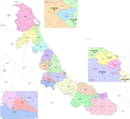
Apazapan is a municipality in the Mexican state of Veracruz. It is located about 65 km from state capital Xalapa. It has a surface of 65.80 km2. It is...
7 KB (300 words) - 06:53, 14 July 2024
Dos Ríos. Xalapa (northwest) Actopan (northeast) Puente Nacional (south) Apazapan (south) Jalcomulco (south) Coatepec (west) As 2020, the municipality had...
7 KB (131 words) - 00:35, 25 January 2024
278 Acatlán Veracruz 279 Actopan Veracruz 279 Alto Lucero Veracruz 279 Apazapán Veracruz 279 Blanca Espuma Veracruz 279 Buena Vista Veracruz 279 Cerro...
30 KB (48 words) - 13:34, 27 June 2024
33,528 +0.9% 430.5 166.2 78.6/km2 (203.6/sq mi) July 9, 1931 017 Apazapan Apazapan 4,709 4,027 +16.9% 67.7 26.1 69.6/km2 (180.2/sq mi) December 1, 1868...
82 KB (1,134 words) - 15:41, 16 July 2024
state capital, Xalapa: Acatlán, Actopan, Alto Lucero de Gutiérrez Barrios, Apazapan, Chiconquiaco, Colipa, Emiliano Zapata, Jalcomulco, Juchique de Ferrer...
19 KB (1,108 words) - 00:04, 21 September 2024
and it covered the municipalities of Actopan, Alto Lucero, La Antigua, Apazapán, Banderilla, Coatepec, Emiliano Zapata, Jalcomulco, Paso de Ovejas, Puente...
19 KB (1,074 words) - 03:51, 4 September 2024
Jalcomulco is bounded to the north by Emiliano Zapata, to the east by Apazapan, to the south and south-west by Tlaltetela, and to the north-west by Coatepec...
9 KB (311 words) - 06:57, 14 July 2024


