
The Crowsnest Highway is an east-west highway in British Columbia and Alberta, Canada. It stretches 1,161 km (721 mi) across the southern portions of...
21 KB (1,532 words) - 19:12, 17 February 2024

Provincial Highway No. 3, commonly referred to as Highway 3 and officially named the Crowsnest Highway, is a 324-kilometre (201 mi) highway that traverses...
78 KB (7,436 words) - 02:25, 8 November 2023

of Crowsnest Pass, and in 1917 a road was blasted around the shores of Crowsnest Lake and across Crowsnest Pass, renamed Interprovincial Highway Three...
11 KB (1,172 words) - 04:50, 30 December 2023
British Columbia Highway 3, officially named the Crowsnest Highway, is an 841-kilometre (523 mi) highway that traverses southern British Columbia, Canada...
29 KB (2,203 words) - 20:35, 10 April 2024
the Crowsnest Highway (Highway 3). Highway 95 follows the Crowsnest Highway northeast for 72 km (45 mi) to the city of Cranbrook, where Highway 95A,...
11 KB (684 words) - 17:16, 29 March 2023
number from U.S. Highway 93 that it connects with at the Canada–United States border. It follows the Crowsnest Highway (Highway 3) and Highway 95 through Radium...
10 KB (645 words) - 22:55, 22 September 2022
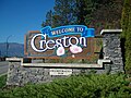
Baillie-Grohman". www.crowsnest-highway.ca. Archived from the original on 2021-10-19. Retrieved 2021-11-21. "Creston's Early Pioneers". www.crowsnest-highway.ca. Archived...
53 KB (3,875 words) - 20:42, 26 June 2024

The highway ends north of the Pembina River. Forestry Trunk Road was a north-south resource road that ran from the Crowsnest Highway (Highway 3) in...
12 KB (558 words) - 05:34, 17 February 2022
designation when the Crowsnest Highway was routed into the Kootenay Pass area in 1964. Originally, a ferry was used to route Highway 3A over the Columbia...
14 KB (1,137 words) - 11:12, 25 April 2024
connection with Idaho State Highway 1 at the Rykerts Canada-U.S. border crossing to a point on the Crowsnest Highway (Highway 3) just 1 km (0.62 mi) west...
3 KB (186 words) - 22:06, 24 April 2024