
The Philippines' National Mapping and Resource Information Authority (Filipino: Pambansang Pangasiwaan sa Pagmamapa at Dulugang Kaalaman), abbreviated...
5 KB (478 words) - 04:47, 24 June 2024

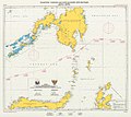
29, the National Mapping and Resource Information Authority (NAMRIA) is mandated to use the designation West Philippine Sea in maps produced and published...
13 KB (1,114 words) - 03:02, 15 July 2024
into an national mapping and cadastral authority (NMCA) and nowadays as a national mapping and geospatial information agency (NMGA). Members of the UN SALB...
29 KB (148 words) - 20:21, 18 June 2024
MT Princess Empress oil spill (section National)
northeast of Balisangan Point, Pola, as recorded by the National Mapping and Resource Information Authority; or at 14.26 km (7.7 nmi) from Balingawan Point,...
48 KB (4,235 words) - 09:09, 27 February 2024
Reclamation Authority granted the request of WMPDI to start its reclamation works. On February 22, 2023, National Mapping and Resource Information Authority (NAMRIA)...
7 KB (365 words) - 19:24, 7 March 2024

List of ports in the Philippines (category Ports and harbors of the Philippines)
the Philippines' exclusive economic zone, and tasked the National Mapping and Resource Information Authority (NAMRIA) to use the name in official maps...
15 KB (169 words) - 12:59, 20 March 2023
Boundary Map (NAMRIA Infomapper Page 4)" (PDF). National Mapping and Resource Information Authority (NAMRIA). Retrieved November 29, 2017. Esmaquel II...
11 KB (1,070 words) - 15:11, 24 June 2024

Field Operations Laguna Lake Development Authority National Mapping and Resource Information Authority National Water Resources Board Natural Resources...
9 KB (587 words) - 08:02, 7 June 2024
Environment and Natural Resources National Mapping and Resource Information Authority National Water Resources Board "Republic Act No. 4850". "LLDA Mandate"...
10 KB (971 words) - 21:57, 20 August 2023
1934 to 1988. A 2010 land cover mapping by the National Mapping and Resource Information Authority (NAMRIA) revealed that the total forest cover of the Philippines...
30 KB (2,943 words) - 00:26, 5 March 2024