
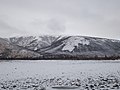
The Ush-Urekchen (Russian: уш-урекчен), or Ushurakchan (Russian: Ушуракчан), is a mountain range in the Chukotka Autonomous Okrug and Kamchatka Krai, Far...
5 KB (472 words) - 04:57, 18 November 2023
Yukaghir Highlands Nera Plateau Kolyma Mountains Omsukchan Range Oloy Range Ush-Urekchen Kedon Range Kongin Range Maymandzhin Range Anadyr Highlands Anadyr Plateau...
7 KB (595 words) - 00:14, 23 January 2024
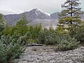
metres (3,380 ft) Oloy Range, highest point 1,816 metres (5,958 ft) Ush-Urekchen, highest point 1,685 metres (5,528 ft) Many right tributaries of the...
5 KB (446 words) - 05:01, 31 March 2024
sources in the Ush-Urekchen range, at the confluence of Left Oloy and Right Oloy. It flows roughly northwestwards between the Ush-Urekchen to the south...
2 KB (151 words) - 11:14, 5 March 2022

with the Yukaghir Highlands to the west. At the western end of the Ush-Urekchen it turns north and crosses Chukotka, briefly enters the Sakha Republic...
4 KB (287 words) - 13:41, 28 November 2023
350 kilometers (220 mi), between the Anyuy Range to the north and the Ush-Urekchen to the south, roughly parallel to both. The Omolon River marks its western...
4 KB (359 words) - 04:57, 18 November 2023

Omolon is situated on the right bank of the Omolon River, with the Ush-Urekchen rising to the north. The village is 670 kilometers (420 mi) from Bilibino...
16 KB (1,410 words) - 19:54, 5 March 2024

and reaching the Anyuy Mountains, as well as the Oloy Range and the Ush-Urekchen. He was also the first to map a 550 km (340 mi) section of the Omolon...
9 KB (1,006 words) - 07:24, 10 November 2023