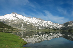
massif, to the south by the Cap-de-Long and Orédon lakes, to the east by the lac de l'Oule and to the north by the col de Barèges. It includes the lakes...
6 KB (496 words) - 03:34, 29 September 2024

of Guy) is situated at the summit. Starting from Pont de l'Oule (east) (at the foot of the Col de Portet d'Aspet), the climb is 10.9 km (6.8 mi) long....
9 KB (616 words) - 06:34, 13 September 2024
List of lakes of France (redirect from Liste des lacs de France)
Noir in the Briançonnais Lac d'Orcières-Merlette Grand lac de l'Oule in the Briançonnais Lac de l'Orceyrette in the Briançonnais Lac Palluel in the massif...
19 KB (2,501 words) - 15:55, 17 June 2024

ISBN 9783829766135. "Le col ou cime de la Bonette ou col de Restefond dans le Tour de France" (in French). ledicodutour. Retrieved 8 August 2022. "Cols du Télégraphe...
84 KB (830 words) - 09:05, 27 August 2024

Barèges Chalet Hotel Lac de L'Oule Vielle Aure Germ Lac d'Oo Bagnères-de-Luchon Fos Refuge de l'Etang d'Araing Eylie d'en haut Cabane de Besset Etang d'Ayes...
8 KB (936 words) - 06:11, 9 September 2023

Valence, Drôme (section Gare de Valence-Ville)
view from the ruins of the Château de Crussol, in front after the first sharp turns in the road on leaving the Col des Limouches [fr], the plain of Valence...
164 KB (18,333 words) - 04:35, 25 September 2024

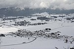
winter, tourists come from the surrounding regions for winter sports at the Col du Rousset ski station (located in the Vercors Mountains). The most popular...
9 KB (896 words) - 09:58, 2 October 2024

comprises two villages, Chauvac and Le Laux, situated at the foot of the Col de Reychasset. The villages are situated 33 kilometres to the southwest of...
2 KB (114 words) - 00:34, 25 August 2024
acts of resistance the town was awarded the Ordre de la Libération. A memorial was built at the Col de la Chau 44°54′27″N 5°21′40″E / 44.90760°N 5.36124°E...
5 KB (398 words) - 11:12, 24 August 2024

Les Lussettes, Moulin de l'Ours, Les Fauries, and Les Miellons. On the commune's northern border lies the mountain pass Col de la Croix Haute, through...
4 KB (425 words) - 17:10, 16 June 2024