
Geophysical imaging (also known as geophysical tomography) is a minimally destructive geophysical technique that investigates the subsurface of a terrestrial...
7 KB (728 words) - 05:10, 28 January 2024

Electrical resistivity tomography (redirect from Electrical resistivity imaging)
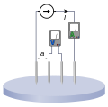
resistivity tomography (ERT) or electrical resistivity imaging (ERI) is a geophysical technique for imaging sub-surface structures from electrical resistivity...
12 KB (1,386 words) - 13:33, 21 January 2024

In archaeology, geophysical survey is ground-based physical sensing techniques used for archaeological imaging or mapping. Remote sensing and marine surveys...
18 KB (2,186 words) - 17:11, 26 May 2024

Document imaging, replicating documents commonly used in business Geophysical imaging Industrial process imaging Medical imaging, creating images of the...
9 KB (985 words) - 08:16, 7 August 2023
In imaging spectroscopy (also hyperspectral imaging or spectral imaging) each pixel of an image acquires many bands of light intensity data from the spectrum...
10 KB (1,271 words) - 02:14, 6 November 2023

Ground-penetrating radar (category Geophysical imaging)
Ground-penetrating radar (GPR) is a geophysical method that uses radar pulses to image the subsurface. It is a non-intrusive method of surveying the sub-surface...
33 KB (4,630 words) - 00:14, 4 June 2024
Induced polarization (category Geophysical imaging)
Induced polarization (IP) is a geophysical imaging technique used to identify the electrical chargeability of subsurface materials, such as ore. The polarization...
6 KB (583 words) - 01:56, 4 March 2024

Magnetotellurics (category Geophysical imaging)
Magnetotellurics (MT) is an electromagnetic geophysical method for inferring the earth's subsurface electrical conductivity from measurements of natural...
35 KB (3,703 words) - 16:41, 6 April 2024
Electrode array (category Geophysical imaging)
Loke, Meng Heng (2004-07-26) [1996]. Tutorial: 2-D and 3-D electrical imaging surveys. Archived from the original (PDF) on 2007-09-27. Retrieved 2007-06-11...
3 KB (301 words) - 08:00, 6 July 2024

Hydrocarbon indicator (category Geophysical imaging)
In reflection seismology, a hydrocarbon indicator (HCI) or direct hydrocarbon indicator (DHI) is an anomalous seismic attribute value or pattern that could...
2 KB (210 words) - 20:28, 5 October 2023