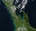
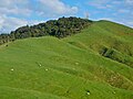
Kaihere is a dispersed Waikato rural settlement on SH27, overlooking the Hauraki Plains. It has a school, hall, domain a rest area and is the starting...
14 KB (753 words) - 23:05, 15 June 2022
in 2001 and grew up in Patetonga in the Hauraki District. She attended Kaihere School. She was born with severe jaundice, cerebral palsy and 80-90% hearing...
8 KB (432 words) - 17:09, 4 September 2024
860 [14] 112 112 Kaiaua School 1–8 Kaiaua State 30 - 1323 1323 Kaihere School 1–8 Kaihere State 29 - 1757 1757 Karangahake School 1–8 Karangahake State...
89 KB (740 words) - 07:04, 26 March 2024
Transport Agency classifies the highway as an arterial route. Traffic at Kaihere increased by 31%, from an average of 3,965 vehicles a day in 2008, to 5...
5 KB (259 words) - 19:59, 25 August 2024

Maratoto Netherton Paeroa Te Moananui Tirohia Plains Ward: Horahia Kaiaua Kaihere Kerepehi Kopuarahi Mangatarata Miranda Ngatea Orongo Patetonga Pipiroa...
9 KB (635 words) - 10:42, 16 September 2024
North, Hauraki Plains East and Hauraki Plains South. They include Turua, Kaihere, Kerepehi, Pipiroa and Waitakaruru, and surround but do not include Ngatea...
22 KB (2,840 words) - 09:01, 16 July 2024

practices. In 1906 work started on cutting the bends in the river below Kaihere Landing. Since the 1930s, considerable flood protection measures have been...
8 KB (892 words) - 04:18, 22 August 2024
and 21 (5.5%) were unemployed. Hauraki Plains South, which also includes Kaihere and Patetonga, covers 251.39 km2 (97.06 sq mi) and had an estimated population...
7 KB (796 words) - 02:17, 15 January 2024
over 8 km (5.0 mi), towards the junction of Ohinewai Rd and SH27, near Kaihere. Maungakawa 535 m (1,755 ft) - Chorus Ltd's microwave tower on the summit...
14 KB (1,112 words) - 16:52, 11 July 2024