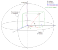
The World Geodetic System (WGS) is a standard used in cartography, geodesy, and satellite navigation including GPS. The current version, WGS 84, defines...
24 KB (2,843 words) - 13:14, 5 October 2024
A geodetic datum or geodetic system (also: geodetic reference datum, geodetic reference system, or geodetic reference frame, or terrestrial reference...
31 KB (3,368 words) - 17:55, 7 November 2024
The Geodetic Reference System 1980 (GRS80) consists of a global reference ellipsoid and a normal gravity model. The GRS80 gravity model has been followed...
7 KB (1,078 words) - 12:07, 24 August 2024
EPSG Geodetic Parameter Dataset (also EPSG registry) is a public registry of geodetic datums, spatial reference systems, Earth ellipsoids, coordinate transformations...
5 KB (450 words) - 10:37, 21 July 2024
December 25, 2018. National Geospatial Intelligence Agency. "World Geodetic System 1984 datasheet" (PDF). United Nations Office for Outer Space Affairs...
9 KB (904 words) - 15:59, 18 September 2024
Web Mercator projection (category Geographic coordinate systems)
MEMBER["World Geodetic System 1984 (Transit)", ID["EPSG",1166]], MEMBER["World Geodetic System 1984 (G730)", ID["EPSG",1152]], MEMBER["World Geodetic System 1984...
16 KB (1,712 words) - 00:20, 1 September 2024
reference for the determining of locators should be based on the World Geodetic System 1984 (WGS-84). A Maidenhead locator compresses latitude and longitude...
16 KB (1,933 words) - 10:09, 4 September 2024
geographic coordinates (latitude and longitude). Examples include the World Geodetic System and the 1927 and 1983 North American Datum. A datum generally consists...
15 KB (1,570 words) - 00:35, 6 September 2024
A geographic coordinate system (GCS) is a spherical or geodetic coordinate system for measuring and communicating positions directly on Earth as latitude...
22 KB (2,491 words) - 18:52, 1 November 2024
Ellipsoid was used. The World Geodetic System WGS84 ellipsoid is now generally used to model the Earth in the UTM coordinate system, which means current...
17 KB (2,844 words) - 21:04, 2 October 2024


