
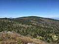
The Lewis Fork Wilderness is an area in the Mount Rogers National Recreation Area protected by the Eastern Wilderness Act of Congress to maintain its...
9 KB (1,016 words) - 18:37, 6 August 2024
Troutdale, Virginia. Most of the mountain is contained within the Lewis Fork Wilderness, while the entire area is part of the Mount Rogers National Recreation...
8 KB (750 words) - 20:20, 18 August 2024

border with Tennessee and North Carolina. It centerpiece is the Lewis Fork Wilderness containing Mount Rogers, the highest point in the state of Virginia...
5 KB (355 words) - 16:36, 2 September 2021

creeks in the Sipsey Wilderness of Bankhead National Forest. The Sipsey Fork discharges into the Mulberry Fork. The Sipsey Fork below Lewis Smith Lake is one...
2 KB (100 words) - 23:02, 22 January 2023

southwest of Troutdale, Virginia between the Lewis Fork Wilderness Area and the Little Wilson Creek Wilderness Area. The Appalachian Trail passes through...
12 KB (1,294 words) - 11:30, 15 May 2024

Monongahela National Forest Laurel Fork North Wilderness Laurel Fork South Wilderness Spice Run Wilderness Big Draft Wilderness Maryland Savage River State Forest...
27 KB (2,625 words) - 19:08, 29 May 2024

the Lewis Fork Wilderness to the east. The Appalachian Trail extends for 6.3 miles through the area, entering on the west from Lewis Fork Wilderness, climbing...
11 KB (1,081 words) - 17:46, 29 January 2024

The Dolly Sods Wilderness (DSW, originally simply Dolly Sods) is a U.S. Wilderness Area in the Allegheny Mountains of eastern West Virginia and is part...
35 KB (4,479 words) - 17:13, 9 August 2024

Hood River (Oregon) (redirect from East Fork Hood River)
from its mouth to its farthest headwaters on the East Fork, the river descends from wilderness areas in the Cascade Range on Mount Hood and flows through...
8 KB (663 words) - 10:29, 23 August 2022

Mountain Wilderness Garden Mountain Wilderness Hunting Camp Creek Wilderness James River Face Wilderness Kimberling Creek Wilderness Lewis Fork Wilderness Little...
28 KB (1,808 words) - 23:09, 6 January 2024