
Original file: [[:en:Image:USA CountiesSVG.zip]] This [[ZIP (file format)|ZIP]] file contains an [[SVG]] map of the [[United States]] showing the borders...
(750 × 550 (160 KB)) - 08:43, 20 October 2022

Original file: [[:en:Image:USA CountiesSVG.zip]] This [[ZIP (file format)|ZIP]] file contains an [[SVG]] map of the [[United States]] showing the borders...
(750 × 550 (147 KB)) - 05:18, 10 September 2020

File:Woodrow Wilson Bridge Location 450x500.PNG (category Locator map images that should use vector graphics)
A map showing the location of the Woodrow Wilson Bridge near Washington, DC. This map was created from information off the U.S. Census Tiger Map server...
(441 × 473 (18 KB)) - 17:45, 14 September 2020
File:Haeju location.png (category Locator map images that should use vector graphics)
Brian0918 1608x2000 (1754847 Bytes) North Korea CREATED/PUBLISHED [Washington, D.C. : Central Intelligence Agency, 1996] NOTES Relief shown by shading...
(500 × 434 (73 KB)) - 01:14, 13 May 2024

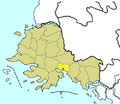
Map created by Kmf164-maps (with the same name) in the English Wikipedia, under the cc-by-sa-2.5 licence. This file is licensed under the Creative Commons...
(252 × 196 (46 KB)) - 04:15, 2 May 2024

designs published by the United States Postal Service since 1978. (See § 313.6(C)(1) of Compendium of U.S. Copyright Office Practices). It also does not apply...
(1,206 × 1,610 (20.42 MB)) - 07:03, 18 August 2024

DescriptionWashington DC Locator.png English: USA map with District of Columbia highlighted. Date 28 September 2014, 09:58:18 Source File:US_Locator_Blank.svg Author...
(998 × 649 (384 KB)) - 05:04, 10 September 2020

designs published by the United States Postal Service since 1978. (See § 313.6(C)(1) of Compendium of U.S. Copyright Office Practices). It also does not apply...
(1,275 × 1,650 (6 MB)) - 07:22, 20 August 2024

DescriptionMap of Washington, D.C.'s 2nd ward.svg Map of the District of Columbia, with Ward 2 highlighted Date 1 February 2008 Source Own work Author...
(667 × 838 (11 KB)) - 06:33, 15 October 2020

DescriptionMap of Washington, D.C.'s 5th ward.svg Map of the District of Columbia, with Ward 5 highlighted Date 1 February 2008 Source Own work Author...
(667 × 838 (11 KB)) - 06:33, 15 October 2020