Flandria Illustrata is a historiographical and topographical work from 1641 by the Flemish canon Antonius Sanderus. It contains historical descriptions...
7 KB (845 words) - 10:30, 10 October 2024
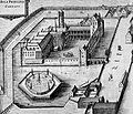
only the postern gate survives. Engraving of the Prinsenhof from Flandria Illustrata (1641) An anonymous 17th century painting depicting the Prinsenhof...
1 KB (169 words) - 11:16, 31 July 2024
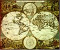
will not be inferior to that of Ptolemy. Farewell. 1538". 1540 Flanders (Flandria). Original, copy by Ortelius, 1595 atlas, 1613 atlas Archived 8 April 2016...
100 KB (12,843 words) - 16:54, 26 October 2024
Sources. Penguin UK. ISBN 9780141909424. Antonius Sanderus (1735). Flandria illustrata, sive provinciae ac comitatus hujus descriptio. Comitum, usque ad...
28 KB (3,204 words) - 13:33, 28 October 2024
"Bevolking per gemeente op 1 januari 2022". Statbel. Sanderus A., Flandria Illustrata, 1638 and 1644, in Latin, reproduced by Tielt, Veys, 1978, In folio...
10 KB (1,135 words) - 22:43, 22 October 2024
1641 map of Lille in Flandria Illustrata by Anton Sander...
66 KB (6,458 words) - 09:39, 1 November 2024
York: Collectors Edition, n.d.) (in German) Antonius Sanderus – Flandria Illustrata (1641–1644) Waagen, G.F. (1847) – Nachtrage zur Kenntnis der altniederländischen...
16 KB (2,123 words) - 23:32, 28 February 2024
the manuscript Hortulus Animae (1510) The Gravensteen, depicted in Flandria Illustrata (1641) View of the Gravensteen's gatehouse in 1823, prior to the...
7 KB (787 words) - 21:27, 29 May 2024
cities of Rijsel and Doornik that appeared in the richly illustrated Flandria Illustrata by the Flemish historian, Antonius Sanderus. The first charts engraved...
11 KB (1,486 words) - 19:24, 30 December 2023
Oldest, the Boldest and the Wisest of Cities. Sanderus wrote in his Flandria Illustrata: "Ninive quattor habet portas. Hae portae, quamvis possint, vix umquam...
17 KB (2,250 words) - 09:32, 10 November 2024


