Milovaig (Scottish Gaelic: Mìolabhaig), comprises two small scattered, mixed crofting and residential townships, consisting of Lower Milovaig to the North...
3 KB (223 words) - 23:22, 22 August 2021

Colbost, Fasach, Glasphein, Holmisdale, Lephin, Hamaraverin, Borrodale, Milovaig, Waterstein, Feriniquarrie, Totaig, Hamara, and others. The Gaelic name...
6 KB (651 words) - 10:53, 22 May 2023
Menai" Merionethshire Meirionydd Welsh Milford Haven Aberdaugleddau Welsh Milovaig Miolabhaig Scottish Gaelic Mold Yr Wyddgrug Welsh Monmouth Trefynwy Welsh...
134 KB (2,086 words) - 06:50, 21 July 2024

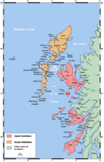
Inverness-shire Borrodale, Colbost, Dunvegan, Edinbane, Geary, Halistra, Milovaig, Roag Absorbed old parish of Trumpan 32,505 1,464 Dull Perth and Kinross...
100 KB (1,041 words) - 22:19, 10 August 2024

Lochmaddy (North Uist) Lower Breakish (Skye) Luib (Skye) Luskentyre (Harris) Milovaig (Skye) Mugeary (Skye) Newtonferry (North Uist) Northbay (Barra) Nunton...
45 KB (4,092 words) - 08:20, 15 June 2024

(Sutherland) Lothbeg, Lower Badcall, Lower Breakish, Lower Diabaig Lower Milovaig, Luib, Lubcroy, Lubinvullin, Lusta, Lybster, Lynchat, Lynne of Gorthleck...
19 KB (1,757 words) - 15:32, 23 January 2024
51750183; -6.43463635 (Camas Lagan) Camas na h-Annait Inverness-shire Milovaig 57°25′34″N 6°46′42″W / 57.42610168°N 6.77833855°W / 57.42610168; -6...
105 KB (4,280 words) - 21:11, 25 April 2024
places such as Gorstan, Carbost, Tolsta, Ardessie, Loch Mullardoch and Milovaig. The current Summerston railway station is about 1+1⁄2 miles (2.4 kilometres)...
15 KB (1,350 words) - 20:01, 25 September 2023
Photo 10 Upper Milovaig Enclosing Wall And Steading 57°26′42″N 6°44′22″W / 57.445075°N 6.739477°W / 57.445075; -6.739477 (10 Upper Milovaig Enclosing Wall...
7 KB (286 words) - 09:37, 3 March 2024

Peinchorran This road is located on the Isle of Skye. B884 A683 at Lonmore near Milovaig This road is located on the Isle of Skye. B885 Portree Bracadale This road...
18 KB (71 words) - 16:09, 8 July 2024