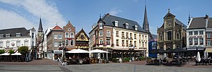
Selfkant (German: [ˈzɛlfkant] ; Dutch: Selfkant or Zelfkant [ˈzɛl(ə)fkɑnt]; Limburgish: Zelfkantj [ˈzæl˦əfˌkɑntʃ˦]) is a municipality in the Heinsberg...
6 KB (685 words) - 08:42, 7 November 2024
acres), the largest parts of which were Elten (near Emmerich am Rhein) and Selfkant. Many other small border corrections were executed, mostly in the vicinity...
20 KB (2,064 words) - 13:38, 30 October 2024
compass points of Germany: North – List on the island of Sylt, West – Selfkant, South – Oberstdorf and East – Görlitz. Together, they always participate...
19 KB (1,875 words) - 13:40, 23 October 2024
Heinsberg is the most westerly district of Germany, reaching 5°52'E in Selfkant municipality. Geographically it covers the lowlands of the Lower Rhine...
4 KB (416 words) - 17:40, 14 August 2024
Donnini's platoon was ordered to attack the small village of Stein in Selfkant Germany, close to the Dutch border. On leaving their trench they immediately...
5 KB (444 words) - 16:39, 7 June 2024
acres), the most relevants parts were Elten (near Emmerich am Rhein) and Selfkant. Many other small border corrections were done, mostly in the vicinity...
59 KB (6,389 words) - 02:59, 17 November 2024
inhabitants in 2016. In its east, Sittard borders the German municipality of Selfkant (in the state of North Rhine-Westphalia). The city centre is located at...
8 KB (796 words) - 19:24, 31 October 2024
Freizeit-Park Tüddern) was a zoo and Germany's first safari park located in Selfkant. The Zoo was founded in 1968, and covered 70 hectares (173.0 acres) while...
2 KB (121 words) - 17:45, 22 October 2024
Protectorate (1947) Paris Protocol (1949) Dutch annexation of Elten and Selfkant (1949) Belgian annexations (1949) Esrablishment of East and West Germany...
43 KB (4,796 words) - 19:38, 20 October 2024
Aplerbecker Mark (51° 28' N, 7° 33' Ö). Its westernmost point is situated near Selfkant close to the Dutch border, the easternmost near Höxter on the Weser. The...
68 KB (5,625 words) - 04:02, 16 November 2024


