the OpenSeaMap website, and can also be downloaded for use as an electronic chart for offline applications. The project is part of OpenStreetMap. OpenSeaMap...
10 KB (1,132 words) - 15:53, 15 April 2023
on OpenStreetMap data. It has been available since mid-2013 at openrailwaymap.org. OpenSeaMap is a world nautical chart built as a mashup of OpenStreetMap...
67 KB (5,944 words) - 12:33, 2 August 2024

Nautical chart (redirect from Sea map)
In modern times, echo sounding is used for measuring the seabed in the open sea. When measuring the safe depth of water over an entire obstruction, such...
17 KB (2,285 words) - 12:06, 2 June 2024

2022-09-13. "Norwegian ENC Data in OpenCPN". 2017-09-11. Wikimedia Commons has media related to OpenCPN. Free and open-source software portal OpenSeaMap v t e...
3 KB (167 words) - 18:43, 6 October 2023

used by Reginald Fessenden to develop sonars. In the free nautical chart OpenSeaMap, 175 seamarks with bells as fog signals have been entered by volunteers...
13 KB (1,518 words) - 06:44, 2 May 2024

www.baken-net.de. Retrieved 21 February 2019. "OpenSeaMap - The free nautical chart". map.openseamap.org. Retrieved 21 February 2019. "UFS TW/EMS". www...
34 KB (3,816 words) - 21:47, 21 June 2024

Sens. 12, 52 Bärlocher, Markus (March 2013). "OpenSeaMap – the Free Nautical Chart" (PDF). openseamap.org. Hydro International. pp. 28–33. "NOAA Hydrographic...
34 KB (4,077 words) - 00:28, 10 November 2023

on the Internet Archive "OpenSeaMap: Frequently Asked Questions". OpenSeaMap.org. Retrieved April 28, 2012. "OpenStreetMap: Copyright and License". Openstreetmap...
46 KB (1,895 words) - 04:27, 29 June 2024
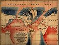
The Open Polar Sea was a conjectured ice-free body of water that was believed to encircle the North Pole. Although this theory was widely accepted and...
6 KB (749 words) - 18:40, 22 May 2024
between 1250m and 1500m along the edge of a basin. "OpenSeaMap - Sinking location". map.openseamap.org. Retrieved 2020-06-09. "Deperm (ADG 10) / ex-YDG-10...
3 KB (165 words) - 07:42, 21 April 2024