related to Augstmatthorn. Augstmatthorn on Hikr Augstmatthorn Wildlife Protection Area Augstmatthorn Drone No-Fly Zone Map Augstmatthorn Hiking Area...
3 KB (202 words) - 19:05, 22 April 2024

Switzerland. It rises in the Alps between the peaks of Hohgant and Augstmatthorn in the canton of Bern. The Emme is 80 kilometres (50 miles) long and...
2 KB (170 words) - 14:24, 8 September 2024

specimens from established populations in Piz Albris, Le Pleureur, and Augstmatthorn. These gave rise to the populations in France and Austria. Alpine ibexes...
44 KB (5,092 words) - 05:00, 23 September 2024
colony was established in 1949 with the release of three bucks from the Augstmatthorn colony. Over the next eight years, a total of 26 animals were released...
4 KB (386 words) - 09:53, 27 April 2023
Reserve Canton Augstmatthorn Bern Combe-Grède Bern Kiental Bern Schwarzhorn Bern Tannhorn Lucerne Uri Rotstock Uri Fellital Uri Mythen Schwyz...
3 KB (73 words) - 23:04, 1 October 2024

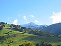
It lies to the west of the Brienzer Rothorn and to the east of the Augstmatthorn. On its southern side it overlooks Lake Brienz. Administratively, the...
2 KB (126 words) - 13:40, 7 May 2022

221 m) Arnihaaggen (2,207 m) Höch Gumme (2,205 m) Hohgant (2,197 m) Augstmatthorn (2,137 m) Pilatus (2,128 m) Schrattenfluh (2,092 m) Widderfeld (2,076...
3 KB (238 words) - 19:17, 1 April 2022

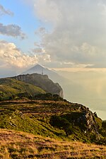
lake and then rises into the alps. In addition to the Tannhorn, the Augstmatthorn and Riederengrat as well as peaks around the Riederengrat are part of...
20 KB (2,249 words) - 23:07, 22 March 2024
67250; 7.39278 Bernese Alps Bern-Mittelland/Frutigen-Niedersimmental Augstmatthorn 2137 272 46°44′32″N 07°55′43″E / 46.74222°N 7.92861°E / 46.74222;...
27 KB (312 words) - 06:35, 6 May 2024