
fortification. The city's red-light district is situated around the Gürtel. The Gürtel was laid out from 1873 at the site of the former Linienwall fortification...
5 KB (445 words) - 12:21, 10 January 2024


Westbahnhof is in Vienna's 15th District (Rudolfsheim-Fünfhaus) on the Gürtel (inner-city ring road). Mariahilfer Strasse to the immediate south-east...
13 KB (1,458 words) - 17:19, 2 January 2024

Trams in Vienna (redirect from Strassenbahn Wien)
streets in the densely built up areas within the Gürtel; the best known example is line 13 from Wien Südbahnhof to Alserstrasse. However, individual sections...
41 KB (3,681 words) - 20:28, 7 March 2024
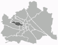
Vienna semi-metro (section Gürtel)
(German for Central Station). In contrast to the other stations of the Gürtel semi-metro, white wall coverings were mounted during the renovation of this...
7 KB (892 words) - 12:57, 3 January 2024
of fortifications around Vienna. Those districts are located within the Gürtel today. The other districts, incorporated between 1874 and 1938, mainly in...
12 KB (999 words) - 17:27, 6 April 2024

Spuren. Historische Streifzüge zwischen Gürtel und Gallitzinberg. Edition Volkshochschule, Manz Verlag, Wien 1999-2001. pp. 159-162. ISBN 3-900799-26-1...
5 KB (600 words) - 05:13, 8 July 2024

Wien Südbahnhof (German for Vienna South Station) was Vienna's largest railway terminus. It closed in December 2009 and was demolished in 2010 to be replaced...
9 KB (1,164 words) - 23:56, 9 January 2024
district of Ottakring is located in the western part of Vienna between the Gürtel (a substantial road around Vienna) and the hills of the Wienerwald (Vienna...
16 KB (1,747 words) - 09:56, 11 September 2023
inside the former Linienwall in the district of Alsergrund, inside the Gürtel. It crossed the Danube at Tulln and extended from there to Krems and to...
4 KB (503 words) - 11:42, 10 February 2024