
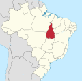
Mateiros is the easternmost city in the state of Tocantins. It is the only city in Tocantins to border the state of Piauí. The municipality is in the microregion...
4 KB (182 words) - 21:09, 17 February 2024

municipalities of Lagoa do Tocantins, Lizarda, Santa Tereza do Tocantins, Mateiros, Novo Acordo, Ponte Alta do Tocantins and São Félix do Tocantins. It has...
5 KB (355 words) - 13:41, 29 February 2024

flat-topped plateaus. The Jalapão State Park lies in the municipality of Mateiros, Tocantins, and has an area of 158,885 hectares (392,610 acres). The park...
5 KB (424 words) - 19:29, 25 January 2024

Jalapão, in the Afro-Brazilian community of Mumbuca in the municipality of Mateiros. Indigenous people, probably from the Xerente ethnic group, taught the...
3 KB (312 words) - 13:40, 29 February 2024
Itacajá Itapiratins Lagoa do Tocantins Lizarda Recursolândia Rio Sono Mateiros Novo Acordo Ponte Alta do Tocantins Santa Tereza do Tocantins São Félix...
30 KB (2,443 words) - 08:09, 11 September 2024

Itacajá Itapiratins Lagoa do Tocantins Lizarda Recursolândia Rio Sono Mateiros Novo Acordo Ponte Alta do Tocantins Santa Tereza do Tocantins São Félix...
24 KB (1,837 words) - 23:31, 26 September 2024

Southernmost town: Paranã Westernmost town: Lagoa da Confusão Easternmost town: Mateiros Highest elevation point: Pico da Neblina 2,994 m (9,823 ft) 0°48′N 66°02′W...
8 KB (838 words) - 09:01, 12 July 2024
Location Country Brazil Physical characteristics Source • location Mateiros, Tocantins • coordinates 10°47′42″S 46°19′50″W / 10.795094°S 46.330606°W...
2 KB (90 words) - 07:51, 26 April 2022

districts: Alegre, Santa Rosa, Pântano de Santa Cruz, Lagamar dos Coqueiros and Mateiro. Its economy is largely promoted by cerrado coffee agriculture (the legitimate...
4 KB (294 words) - 00:43, 31 March 2024
(Gavião Branco Norte, Gavião Tesoura, Gavião Carijó, Gavião Belo and Gavião Mateiro). It also has seven Discovery Assessment Plans (PADs), seven exploration...
18 KB (1,752 words) - 18:52, 8 May 2024