
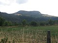
department, in the commune of Rieutort-de-Randon, near the Truc de Randon [fr] and the Signal de Randon. The Truc de Fortunio is a summit of the Charpal...
3 KB (214 words) - 15:15, 4 April 2024

and Javols, and probably takes up an older boundary. The Signal de Randon and the truc de Fortunio are the highest points of the Margeride horst and are...
2 KB (145 words) - 03:05, 25 June 2024

and peaks of the Margeride are: Signal de Randon, 1,551 m (5,089 ft) Truc de Fortunio, 1,550 m (5,090 ft) Moure de la Gardille, 1,503 m (4,931 ft) Mont...
12 KB (1,354 words) - 06:04, 22 May 2024

occupation of Gaul, an oppidum had been constructed for defence on the Truc de Grèzes, a hill (1 008 m) near the present day village. During the Gallo-Roman...
3 KB (377 words) - 02:15, 3 September 2022

southern France. On 1 January 2019, it was merged into the new commune Monts-de-Randon. The Colagne flows westward through the southern part of the commune....
2 KB (93 words) - 22:57, 28 April 2023
Saint-Bonnet-de-Chirac (French pronunciation: [sɛ̃ bɔnɛ də ʃiʁak]; Occitan: Sant Bonet) is a commune in the Lozère department in southern France. The Colagne...
2 KB (103 words) - 01:02, 3 August 2023
Grèzes Commune The château of Grèzes, seen from the Truc de Grèzes Location of Grèzes Grèzes Show map of France Grèzes Show map of Occitanie Coordinates:...
2 KB (71 words) - 01:00, 3 August 2023

Brenoux Commune The Truc de Balduc seen from Mont Mimat, Brenoux is in the valley to the left Location of Brenoux Brenoux Show map of France Brenoux Show...
2 KB (73 words) - 13:23, 23 November 2023

Saint-Bauzile Commune The Truc de Balduc seen from Mont Mimat Location of Saint-Bauzile Saint-Bauzile Show map of France Saint-Bauzile Show map of Occitanie...
2 KB (68 words) - 23:47, 31 May 2024