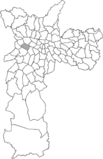
Alto de Pinheiros is a district in the subprefecture of Pinheiros of the West Zone of São Paulo, Brazil. 23°32′57″S 46°42′51″W / 23.54917°S 46.71417°W...
3 KB (40 words) - 09:29, 10 September 2022

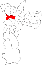
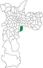
Vila Madalena (category Neighbourhoods in São Paulo)
the Pinheiros district in the West Zone of São Paulo, Brazil. The neighborhood is known for its bustling nightlife and its history as a center of São Paulo...
3 KB (233 words) - 02:34, 9 October 2024
São Paulo, called Distritos (districts), are subdivisions of the boroughs, without a self-government. Some districts are further divided into bairros...
12 KB (251 words) - 04:44, 31 March 2024
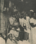
Samba (redirect from Samba de roda)
Portuguese). São Paulo: University of São Paulo. Retrieved 7 August 2020. Ferraz, Igor de Bruyn (2018). Um samba sem poluição": o partido-alto de Candeia em...
199 KB (23,046 words) - 15:38, 5 October 2024
(Poveiros House) in Brazil (Rio de Janeiro and São Paulo), Germiston in South Africa and Toronto in Canada. In Rio de Janeiro, the community was known...
149 KB (16,107 words) - 20:07, 15 August 2024
Subprefecture of Lapa (category Subprefectures of São Paulo)
The Subprefecture of Lapa is one of 32 subprefectures of the city of São Paulo, Brazil. It comprises six districts: Lapa, Barra Funda, Perdizes, Vila...
4 KB (193 words) - 09:31, 10 September 2022

Itapevi (category Municipalities in São Paulo (state))
municipality in the state of São Paulo located in the western part of the Greater São Paulo metropolitan area (35 km to the west of São Paulo city). The population...
16 KB (1,520 words) - 09:17, 20 September 2024

Igreja Nossa Senhora do Brasil (category Roman Catholic churches in São Paulo)
the Cross in the church. Tourism in the city of São Paulo Ponciano, Levino (2001). Bairros Paulistanos de A a Z. Senac. p. 12. ISBN 978-85-7359-223-8. Retrieved...
6 KB (538 words) - 13:52, 3 May 2024

Consolação Street (category Streets in São Paulo)
from the Pinheiros Path (Caminho de Pinheiros), a road that existed during colonial Brazil and connected Vila de São Paulo to Vila de Pinheiros. It marked...
8 KB (734 words) - 13:21, 24 April 2024
Sacomã (redirect from Sacomã (district of São Paulo))
city of São Paulo, Brazil. Sacomã is a district located in the southeast region of the municipality of São Paulo, in the state of São Paulo, Brazil....
3 KB (161 words) - 13:47, 3 September 2024