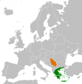
DescriptionGreece Serbia Locator.png English: Greece and Serbia Date 9 June 2008 Source Own work (Original text: Self-made) Author Izmir lee...
(947 × 973 (54 KB)) - 01:17, 28 March 2022
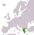
org/wiki/Image:Greece Turkey Locator.png değiştirildi. |tarih= |yazar=[[Kullanıcı:Vikiyazar]] |izinler= |diğer_sürümler= }} İngilizce Wiki'deki telif hakkı serbes English...
(1,200 × 1,000 (65 KB)) - 00:12, 2 January 2024
Indicating Greece and Republic of Macedonia now, instead of Greece and Serbia. The original can be viewed here: Greece Serbia Locator.png: . Modifications...
(1,236 × 1,245 (59 KB)) - 15:31, 16 October 2020
png" 2011-04-10T20:05:09Z Alphathon 680x520 (568373 Bytes) Improved Serbia, Montenegro and surrounding countries using data from "File:Serbia Map.png"...
(450 × 456 (500 KB)) - 10:10, 25 April 2023
File:Czechoslovakia 1956–1990.svg (category Locator maps of Czechoslovakia)
png" 2011-04-10T20:05:09Z Alphathon 680x520 (568373 Bytes) Improved Serbia, Montenegro and surrounding countries using data from "File:Serbia Map.png"...
(450 × 456 (474 KB)) - 11:07, 30 April 2024
[[:Image:TAAF-CIA WFB Map.png]] 2008-02-17T17:00:48Z IAMTHEEGGMAN 1425x625 (58032 Bytes) Kosovo has declared independence from Serbia 2008-01-26T17:10:27Z...
(1,425 × 625 (43 KB)) - 22:52, 17 April 2023
File:Kingdom of Prussia 1815.svg (category Locator maps of the Kingdom of Prussia)
png" 2011-04-10T20:05:09Z Alphathon 680x520 (568373 Bytes) Improved Serbia, Montenegro and surrounding countries using data from "File:Serbia Map.png"...
(450 × 456 (734 KB)) - 10:09, 25 April 2023
File:Weimar Republic 1930.svg (category Locator maps of the Weimar Republic)
png" 2011-04-10T20:05:09Z Alphathon 680x520 (568373 Bytes) Improved Serbia, Montenegro and surrounding countries using data from "File:Serbia Map.png"...
(450 × 456 (483 KB)) - 20:57, 11 October 2024
File:Kingdom of Sardinia 1815.svg (category Locator maps of the Kingdom of Sardinia (1859))
png" 2011-04-10T20:05:09Z Alphathon 680x520 (568373 Bytes) Improved Serbia, Montenegro and surrounding countries using data from "File:Serbia Map.png"...
(450 × 456 (702 KB)) - 08:00, 20 July 2024
File:Kingdom of Saxony 1815.svg (category SVG locator maps of former countries of Europe (gray and green scheme))
png" 2011-04-10T20:05:09Z Alphathon 680x520 (568373 Bytes) Improved Serbia, Montenegro and surrounding countries using data from "File:Serbia Map.png"...
(450 × 456 (812 KB)) - 10:09, 25 April 2023


