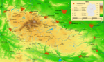
DescriptionHarz map.png Map of the Harz mountains in Germany with mountains, rivers, lakes, reservoirs, all highways, all Bundesstraßen, Harzquerbahn,...
(2,529 × 1,523 (3.15 MB)) - 08:33, 16 August 2024

Map of the Macizo del Harz in Germany (PNG-VERSION in Spanish). Detailed map of large dimension. For a better viewing, click on the link of the image above...
(2,577 × 1,526 (3.21 MB)) - 12:16, 21 November 2022

choice. This image is a derivative work of the following images: File:Harz_map.png licensed with Cc-by-sa-3.0-migrated, GFDL-GMT 2009-12-15T16:05:03Z Bamse...
(1,204 × 990 (1.1 MB)) - 20:21, 12 June 2024

Map of the Macizo del Harz in Germany Detailed map of large dimension. For a better viewing, click on the link of the image above. Mapa detallado de gran...
(10,084 × 5,973 (3.64 MB)) - 20:47, 5 July 2024

DescriptionHarz map blank.png Map of the Harz mountains in Germany with mountains, rivers, lakes, reservoirs, all highways, all Bundesstraßen, Harzquerbahn...
(2,529 × 1,523 (2.42 MB)) - 03:42, 6 September 2020

DescriptionHarz map 1860.png Deutsch: Karte des Harz um 1860 Date 1864 Source Baedecker, Deutschland nebst theilen der angrenzenden lánder bis Strassburg...
(1,545 × 1,025 (203 KB)) - 06:16, 5 July 2024

{{Information |Description= {{en|Germany / Harz: map of walking-tour Oderteich - Torfhaus - (Wolfswarte)}} {{de|Harz - Plan zur Wanderung Oderteich - Torfhaus...
(1,584 × 1,699 (878 KB)) - 10:31, 8 July 2024

DescriptionHarz map OG.png Deutsch: Ohmgebirge und Bleicheröder Berge Date 9 April 2015 Source Author Bamse, bearbeitet von 79.214er Other versions This...
(729 × 597 (371 KB)) - 11:38, 11 July 2024

DescriptionHarz map Huy.png Deutsch: Die Huy im nördlichen Harzvorland Date 9 April 2015 Source Author Bamse, bearbeitet von 79.214er Other versions This...
(1,174 × 593 (498 KB)) - 11:26, 8 July 2024

DescriptionHarz map EB.png Deutsch: Naturräume des Eichsfelder Beckens und der näheren Umgebung (braun) Date 1 April 2015 Source Author Bamse Other versions...
(893 × 1,005 (887 KB)) - 03:22, 17 September 2020