
 French
 Deutsch
Datei:Map of New South Wales as occupied by the native tribes.jpg – Wikipedia
Originaldatei (2.000 × 1.750 Pixel, Dateigröße: 834 KB, MIME-Typ: image/jpeg)
![]()
Diese Datei und die Informationen unter dem roten Trennstrich werden aus dem zentralen Medienarchiv Wikimedia Commons eingebunden.
![]()
Beschreibung
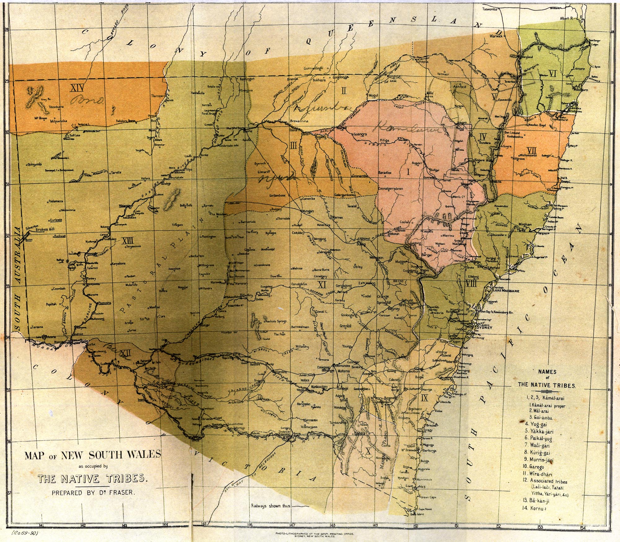
Map of the aboriginal tribes of New South Wales by John Fraser, published in An Australian Language in 1892.
Lizenz
| Dieses Werk ist gemeinfrei, weil seine urheberrechtliche Schutzfrist abgelaufen ist.
| |
| Es wurde festgestellt, dass diese Datei frei von bekannten Beschränkungen durch das Urheberrecht ist, alle verbundenen und verwandten Rechte eingeschlossen. | |
Dateiversionen
Klicke auf einen Zeitpunkt, um diese Version zu laden.
| Version vom | Vorschaubild | Maße | Benutzer | Kommentar | |
|---|---|---|---|---|---|
| aktuell | 03:30, 26. Mär. 2006 | | 2.000 × 1.750 (834 KB) | Ptcamn~commonswiki | Map of the aboriginal tribes of New South Wales by John Fraser, published in ''An Australian Language'' in 1892. Category:Maps of AustraliaCategory:Maps of Aboriginal AustraliaCategory:Historical maps |
Dateiverwendung
Die folgende Seite verwendet diese Datei:
Globale Dateiverwendung
Die nachfolgenden anderen Wikis verwenden diese Datei:
- Verwendung auf en.wikipedia.org
- Verwendung auf es.wikipedia.org
- Verwendung auf fr.wikipedia.org
- Verwendung auf id.wikipedia.org
- Verwendung auf it.wikipedia.org
- Verwendung auf ms.wikipedia.org
- Verwendung auf pt.wikipedia.org
- Verwendung auf zh.wikipedia.org